

Automatische 3D-Punktwolken-Klassifizierung und -Analyse.
KI-gestützte 3D-Punktwolkenklassifizierung und -analyse
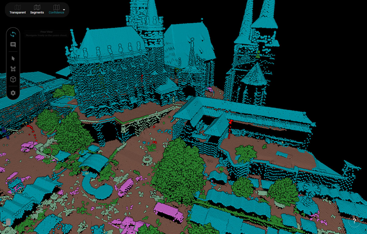
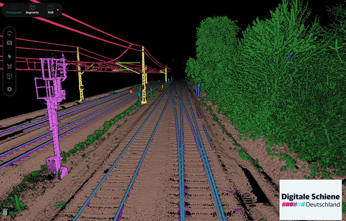
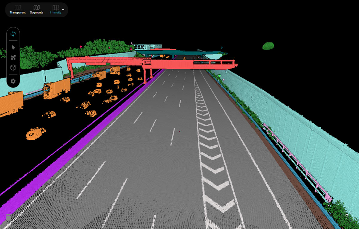
Pointly ermöglicht die automatisierte Klassifizierung von großflächigen Punktwolken mithilfe von künstlicher Intelligenz und wandelt Rohdaten in strukturierte Informationen um.
Punktwolkenmanagementsystem zum Verwalten und Organisieren von Punktwolken
Pointly ist nicht nur ein leistungsstarkes Klassifizierungswerkzeug, sondern auch eine Plattform für das umfassende Management Ihrer Punktwolkenprojekte.
Punktwolkenmanagementsystem zum Verwalten und Organisieren von Punktwolken
Pointly ist nicht nur ein leistungsstarkes Klassifizierungswerkzeug, sondern auch eine Plattform für das umfassende Management Ihrer Punktwolkenprojekte.



Sie sehen gerade einen Platzhalterinhalt von YouTube. Um auf den eigentlichen Inhalt zuzugreifen, klicken Sie auf die Schaltfläche unten. Bitte beachten Sie, dass dabei Daten an Drittanbieter weitergegeben werden.
Mehr InformationenSie sehen gerade einen Platzhalterinhalt von YouTube. Um auf den eigentlichen Inhalt zuzugreifen, klicken Sie auf die Schaltfläche unten. Bitte beachten Sie, dass dabei Daten an Drittanbieter weitergegeben werden.
Mehr InformationenDas ist POINTLY
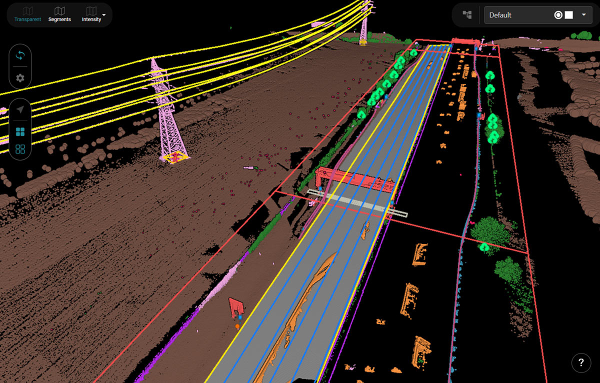
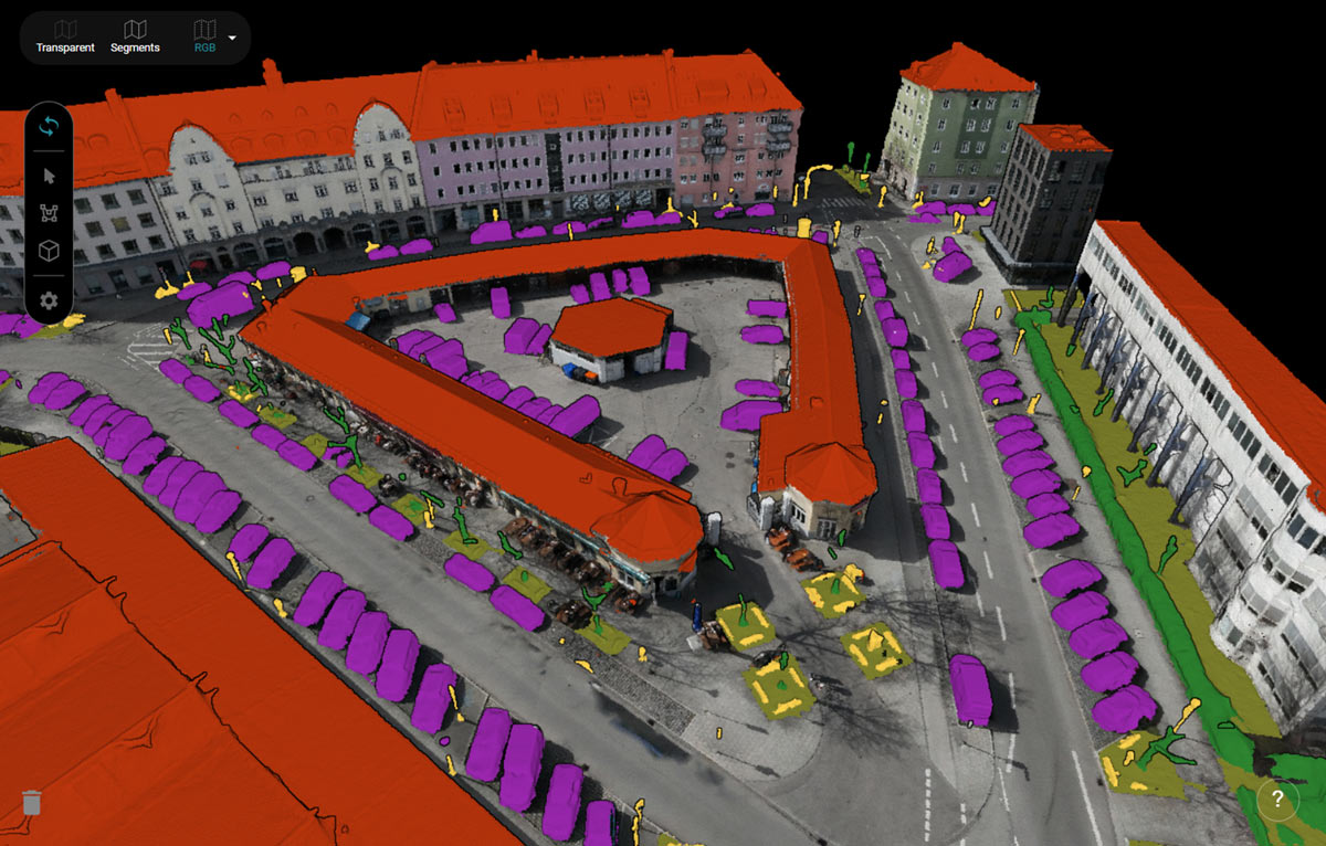
Pointly ist eine intelligente, cloudbasierte B2B-Punktwolken-Managementlösung, die eine schnelle und einfache Klassifizierung großer 3D-Punktwolkendaten ermöglicht.
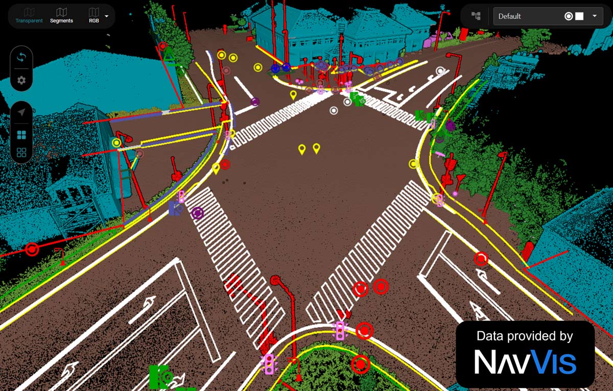
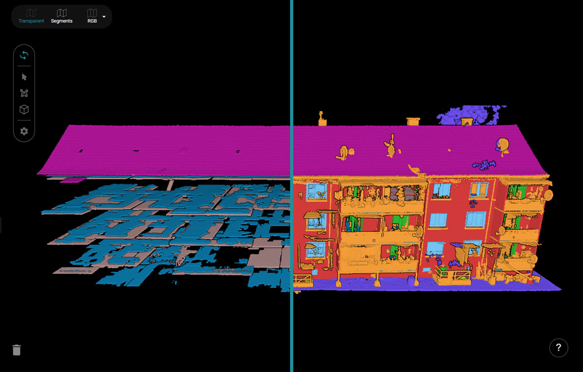
Dank moderner KI-Technologie können sowohl automatische als auch präzise manuelle Klassifizierungen effizient durchgeführt werden, wodurch die Arbeit schneller und die Kosten für die Klassifzierung geringer werden. Ein durchdachtes Toolset unterstützt zudem die einfache Vektorisierung für die Erstellung präziser CAD-Modelle.
Die wichtigsten Funktionen von Pointly.
Pointly macht die Arbeit mit Punktwolken einfach und effizient, indem Klassifizierungs- und Vektorisierungsfunktionen mit KI-Technologie in einer nutzerfreundlichen, cloudbasierten Punktwolkenmanagement-Plattform kombiniert werden.
Vortrainierte KI-Modelle
KI-Modelle zur automatischen Klassifizierung von 3D-Punktwolken vortrainiert für gängige Anwendungsfälle. Alle Nutzerinnen und Nutzer der Plattform können darauf zugreifen.

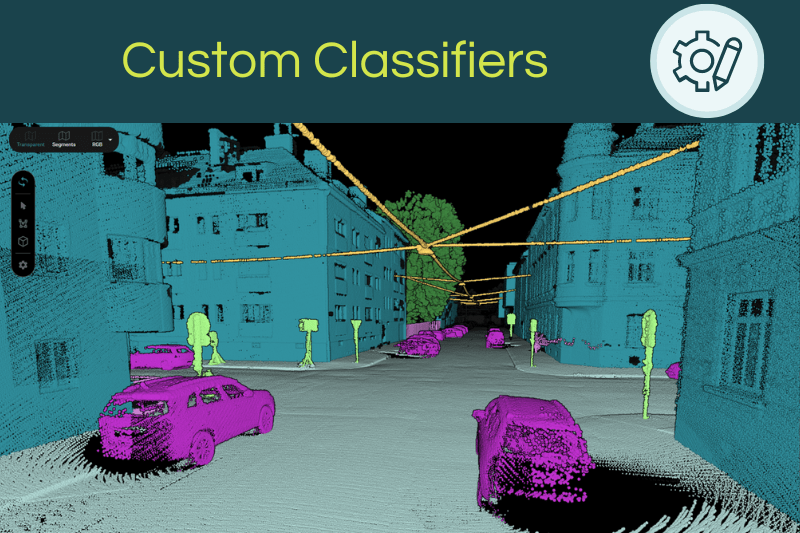
Kundenspezifische KI-Modelle
Haben Sie einen speziellen Anwendungsfall? Wir entwickeln ein maßgeschneidertes KI Modell für Ihr Projekt. Kontaktieren Sie uns unter sales@pointly.ai

Automatische Vektorisierung
Ergänzend zur automatischen Klassifizierung ermöglicht Pointly die automatische Erstellung von Vektormodellen. Auf Basis der klassifizierten Punktwolke und abgestimmt auf Ihre individuellen Anforderungen erzeugen wir passgenaue Vektormodelle und stellen diese in jedem offenen Vektorformat bereit. Auf Wunsch sind weitere Datenprodukte verfügbar.
Tools für Manuelle Klassifizierung
Neben der automatischen Klassifizierung stellt die Plattform alle Werkzeuge für die manuelle Annotation der Punktwolke bereit. Die benutzerfreundlichen Tools ermöglichen eine schnelle und effiziente manuelle Klassifizierung direkt in der Plattform.
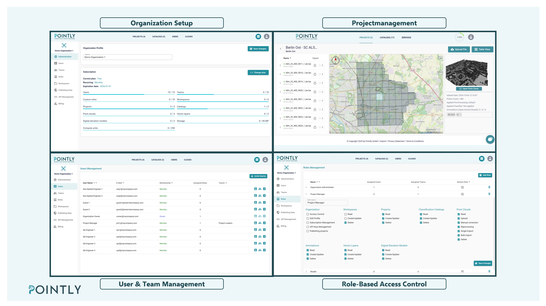
Punktwolken-Managementsystem
Die Pointly Plattform ist ein cloudbasiertes Punktwolken-Managementsystem zum Verwalten und Organisieren Ihrer Punktwolken. Die Plattform dient als zentraler Speicherort für alle Ihre Punktwolken.
Teilen Sie Ihre Projekte innerhalb des Teams schnell und einfach dank einer nutzerfreundlichen Cloud‑Umgebung.
Weitere Vorteile.
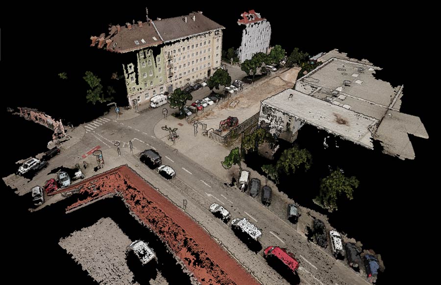
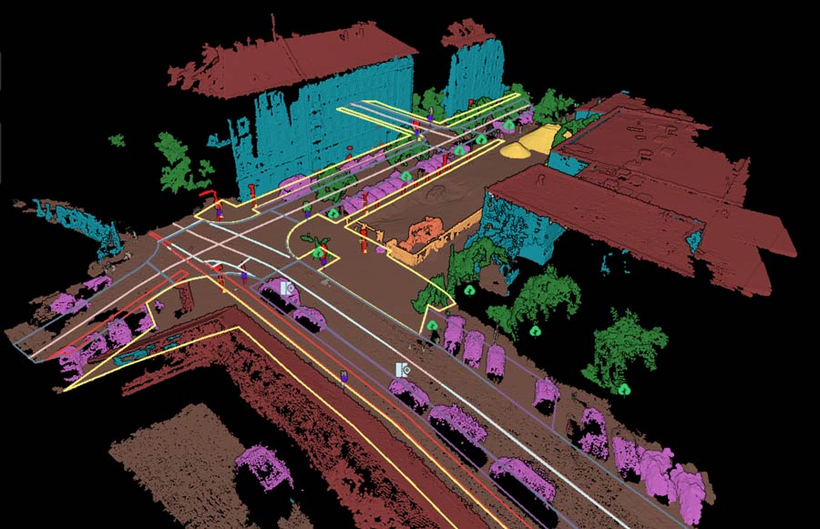
API- und On-Premise-Klassifizierung: Nutzen Sie unsere Klassifikatoren über eine API. Auf diese Weise können Sie Klassifizierungsmodelle in externe Workflows und Plattformen integrieren. Mit der „Pointly Box“ können Sie den Klassifikator auch als individuelles Softwarepaket erhalten, das lokal ausgeführt werden kann.
Zusammenarbeit: Teilen Sie Projekte mit Ihrem Team und Ihren Kunden von überall auf der Welt. Fügen Sie Tags und Anmerkungen direkt im Punktwolken-Viewer zu den Dateien hinzu.
Sichere Cloud-Verarbeitung: Ihre Daten sind bei uns sicher. Wir schützen Ihre Daten sowohl bei der Speicherung als auch während der Übertragung.
Skalierbarkeit: Die Plattform ist für die Verarbeitung großer Punktwolkendatenmengen ausgelegt. Wenn mehr Daten hochgeladen werden, startet Pointly dynamisch zusätzliche Maschinen, um auch bei Spitzenauslastung eine effiziente parallele Verarbeitung zu gewährleisten. Auf diese Weise kommt es nie zu Verarbeitungsengpässen.
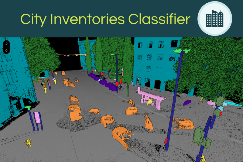
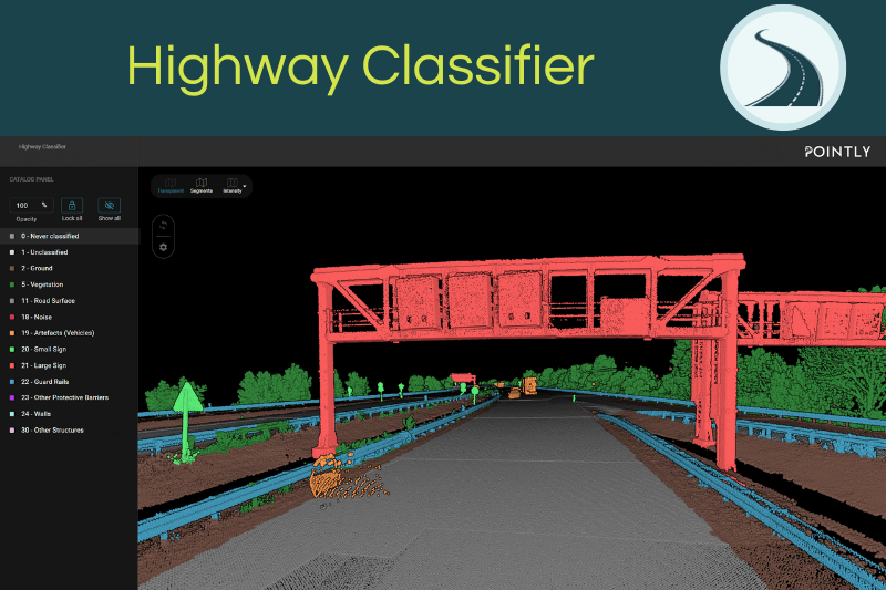
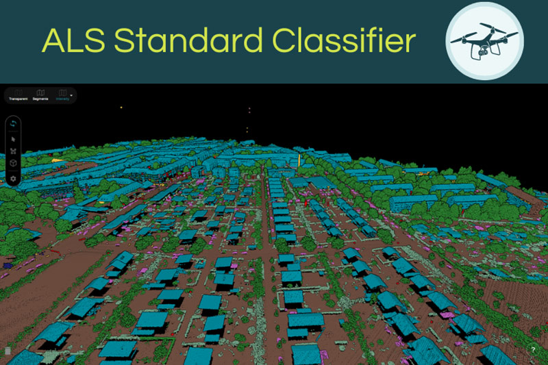
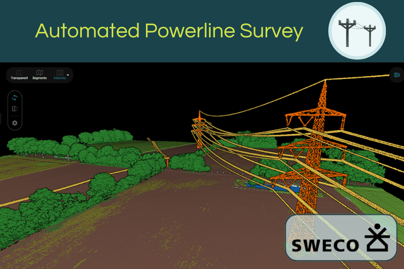
Vortrainierte Modelle für Punktwolken Klassifizierung.
Pointly stellt verschiedene vortrainierte KI-Modelle bereit, passend für die automatische Klassifizierung unterschiedliche Datentypen und Anwendungsfälle.
Einfacher loslegen.
Fordern Sie jetzt eine Demo der Pointly Plattform an und erfahren Sie mehr über unsere KI‑Dienstleistungen.
Their deep understanding of our needs and goals, as well as their ability to tackle complex challenges with creative and effective solutions, was remarkable. The collaboration was marked by professional and friendly engagement, with communication always open and responsive. Pointly has exceeded our expectations, laid a solid foundation for the further development of our product, and is undoubtedly worthy of recommendation.
Key game changer option is to collaborate with annotators by tagging and commenting on point clouds directly in the 3D view. It solved the issue of endless slides with screenshots and multiple rounds of verifications. It was a pleasure to work with the team!
GeoSpatial Feature Extraction Solutions,
Trimble Inc.
Finally, we could do different vegetation analysis with the data, for example a forest canopy analysis. We are extremely happy with the re-classification results and friendly & fast service of Pointly!
The trained model not only added a lot of information to the current dataset, but also provided a solid basis for applying the model to future aerial surveys.
What used to be a cumbersome process, taking days of manual finetuning for the classifications can now be done in a fraction of the time - with higher consistency and greater accuracy.
The collaboration was exceptionally smooth. Pointly didn't act like a black box - they kept us in the loop throughout development, communicating progress and discussing potential risks transparently. We can confidently say that the results have exceeded our expectations. We look forward to further exploring how this technology can improve our coastal monitoring data workflow.
Project Manager for the Regional Coastal Monitoring Programme
What stands out the most to us is Pointly’s adaptability – the new approach can learn continuously. Thus, any manual correction to the automatic classification (if necessary at all) improves the process for future applications.”








Von Experten entwickelt.
Geo-Data-Science Technology aus Deutschland.
Dieses Projekt wird vom Bundesministerium für Wirtschaft und Klimaschutz (BMWK) auf Grundlage eines Beschlusses des Deutschen Bundestages gefördert.
