
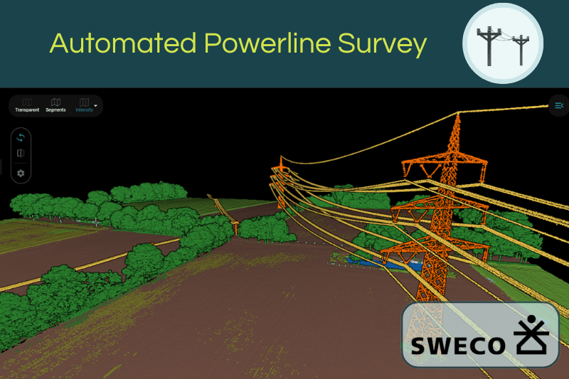
AI-powered 3D Point Cloud Classification
and Analysis.
AI-powered 3D Point Cloud Classification and Analysis
Pointly enables the automated classification of large-scale point clouds using artificial intelligence, turning raw data into structured information.
Centralized Cloud-Platform for Point Cloud Management
Easily store, manage, and structure your point cloud data in one system.
Centralized Cloud-Platform for Point Cloud Management
Easily store, manage, and structure your point cloud data in one system.


You are currently viewing a placeholder content from YouTube. To access the actual content, click the button below. Please note that doing so will share data with third-party providers.
More InformationYou are currently viewing a placeholder content from YouTube. To access the actual content, click the button below. Please note that doing so will share data with third-party providers.
More InformationThis is POINTLY
Pointly is a smart, cloud-based B2B point cloud management solution that allows fast and easy classification of large 3D point cloud data.
Our innovative AI techniques enable efficient automatic as well as advanced manual classification in 3D point clouds – making this process faster and more precise for you than ever before. An intuitive toolset allows for easy vectorization to draw precise 3D models.

Pointly's Key Features.
Pointly simplifies and streamlines working with point clouds by combining classification and vectorization powered by AI in a user-friendly, cloud-based point cloud management platform.
Standard Classifiers (Pre-trained AI Models)
AI models for automatic classification of 3D point clouds, pre-trained for common use cases. All platform users have access to them.

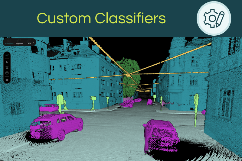
Custom AI Models
Have a specific use case? We develop tailored AI models for your project. Get in touch with us at sales@pointly.ai

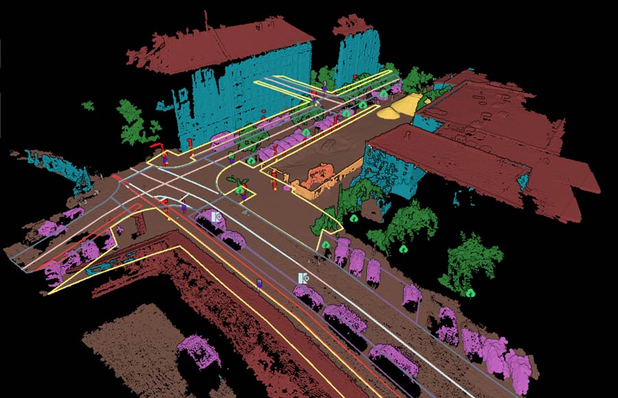
Automatic Vectorization
In addition to automatic classification, Pointly enables automatic generation of vector models. Based on the classified point cloud and aligned with your custom requirements, we automatically create tailored vector models and deliver them in any open vector format. If required, further data products are available such as PDF reports or other requested outputs.
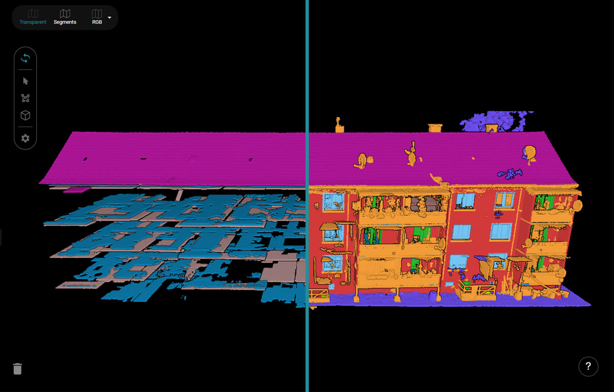
Tools for manual classification
In addition to automatic classification, the platform provides all the tools needed for manual point cloud annotation. The intuitive tools enable fast and efficient manual classification directly within the platform.
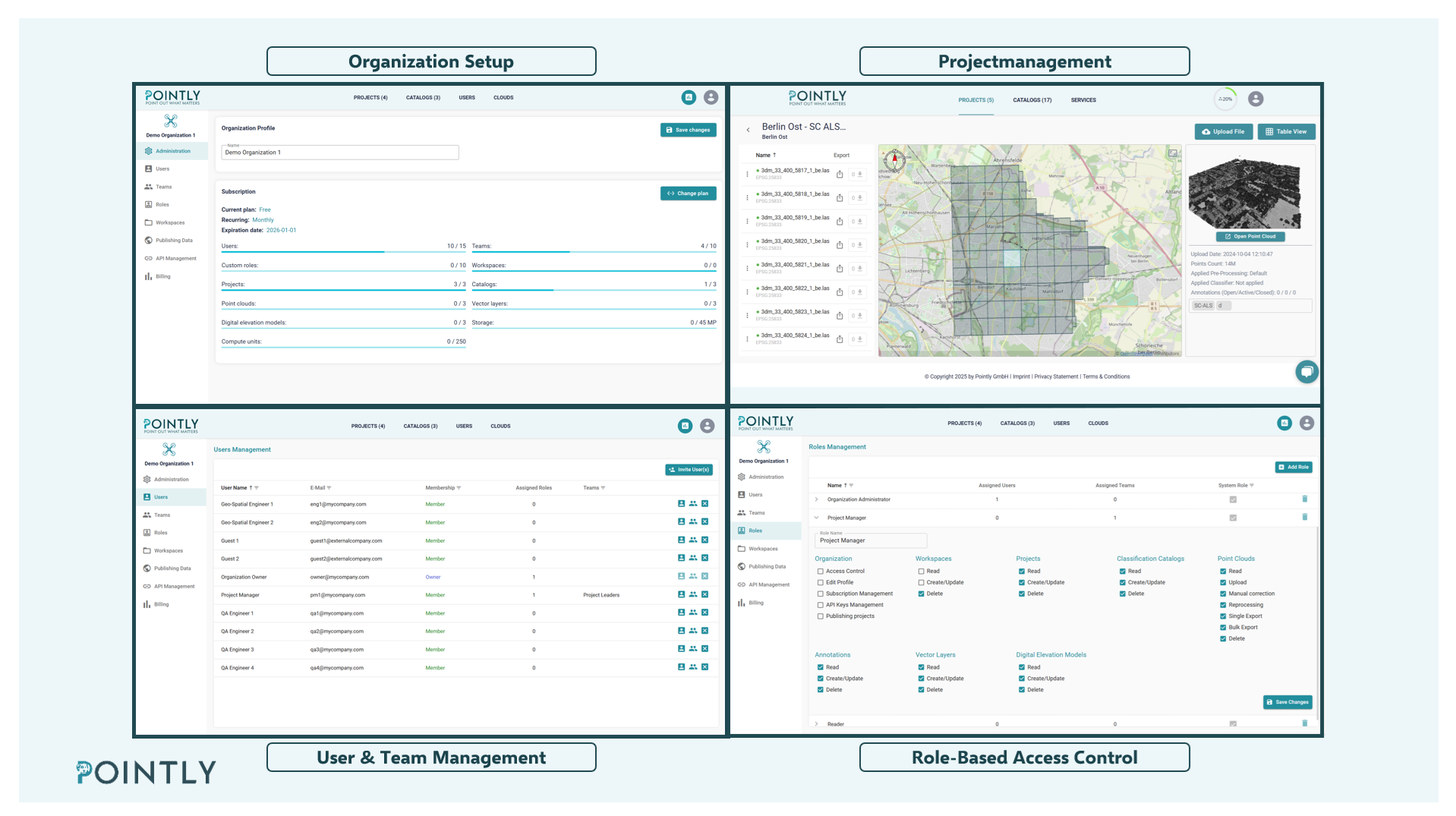
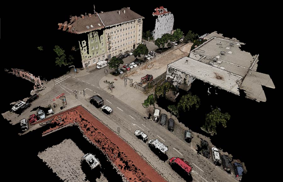
Point Cloud Management System
The Pointly platform is a cloud-based system for managing and organizing your point cloud data. It serves as a central hub for all your point clouds.
Easily share projects within your team thanks to a user-friendly cloud environment.
More Benefits.
API & On-Premise Classification: Utilize our classifiers via an API. This way you can integrate classification models into external workflows and platforms. With the “Pointly Box” you can also get the classifier as a custom software package that can be run locally.
Collaboration: Share projects with your team and clients from anywhere in the world. Add tags and annotations to the files directly in the point cloud viewer.
Secure Cloud Processing: Your data is safe with us. We protect your information whether in storage or transit.
Scalability: The platform is designed to handle large-scale point cloud data. As more data is uploaded, Pointly dynamically starts additional machines to ensure efficient parallel processing even during peak demand. This way, you will never run into processing bottlenecks.
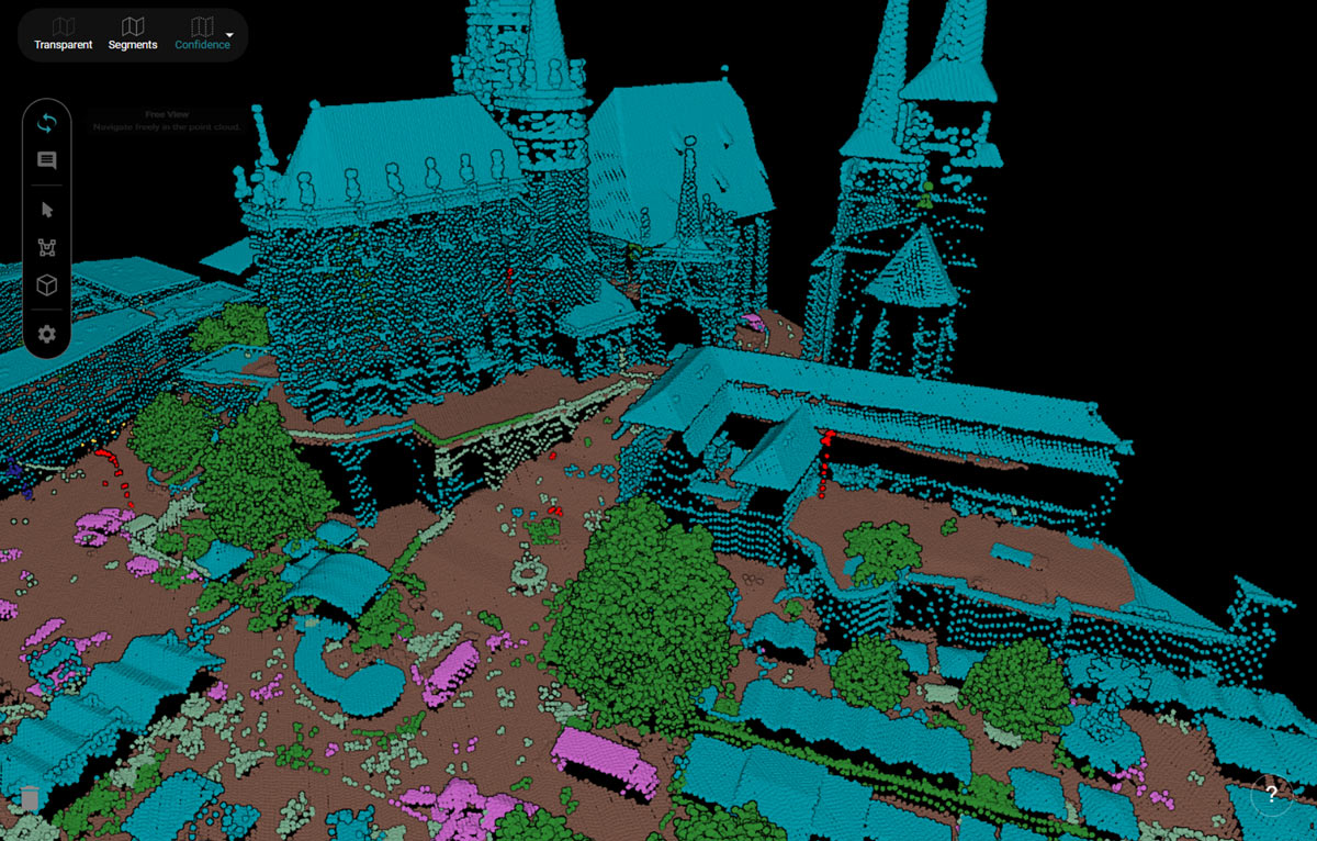
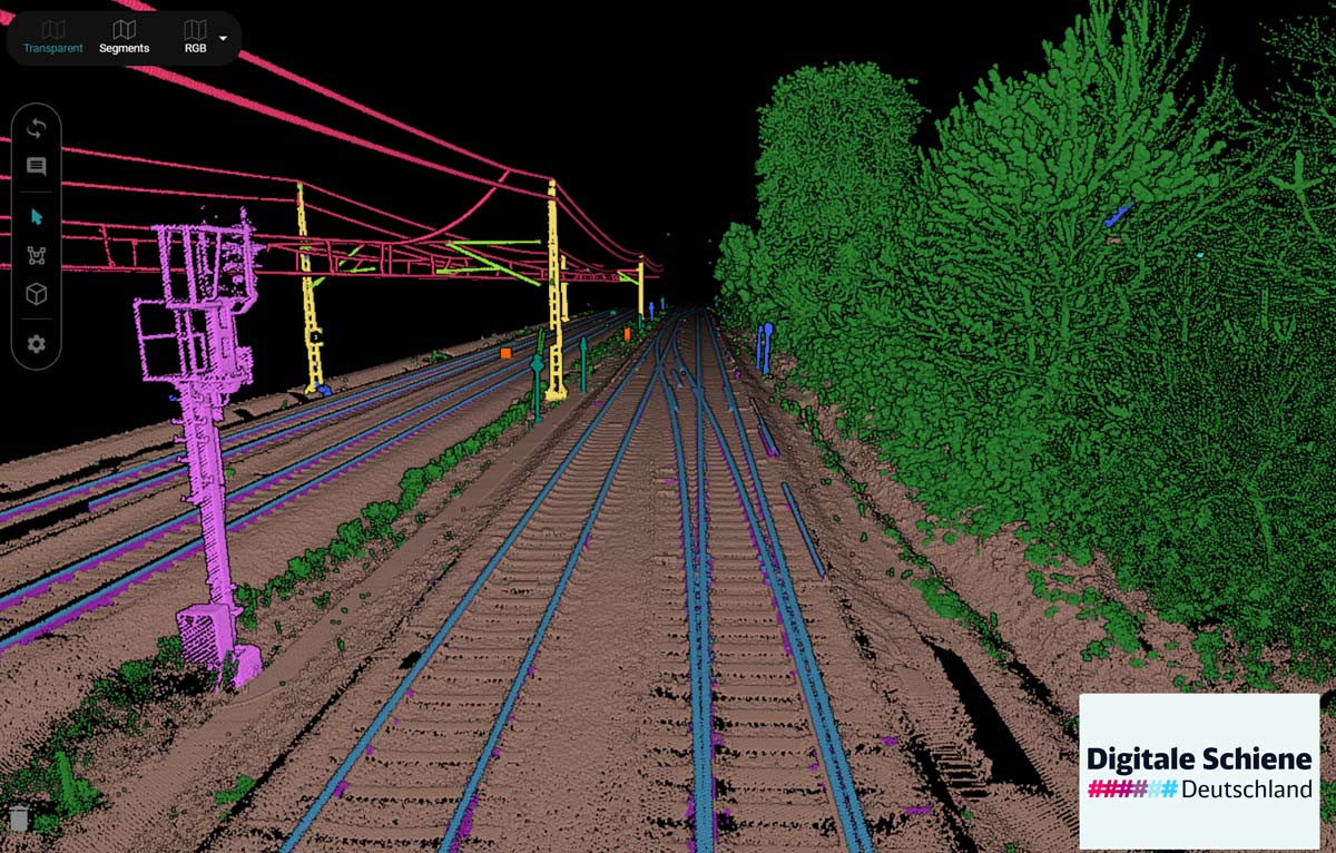
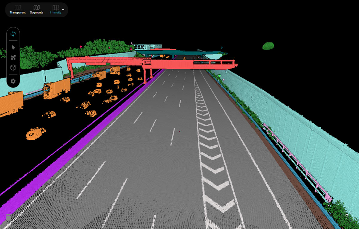
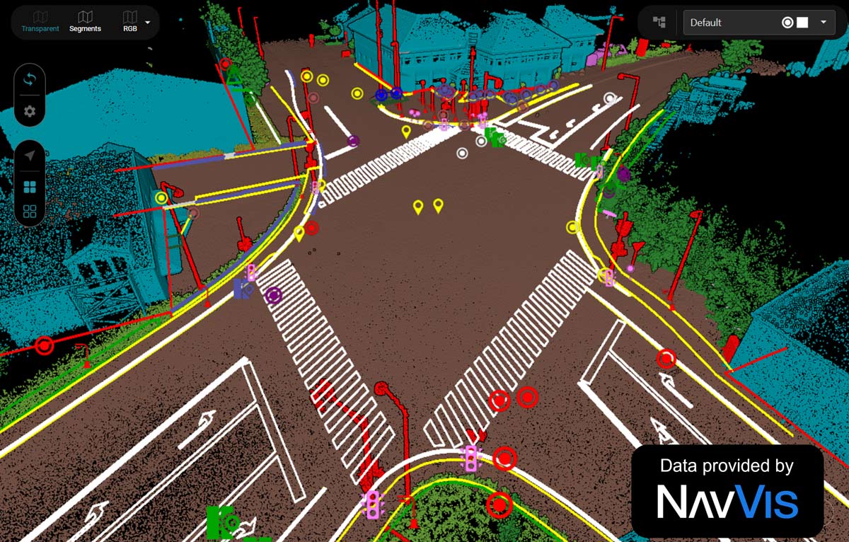
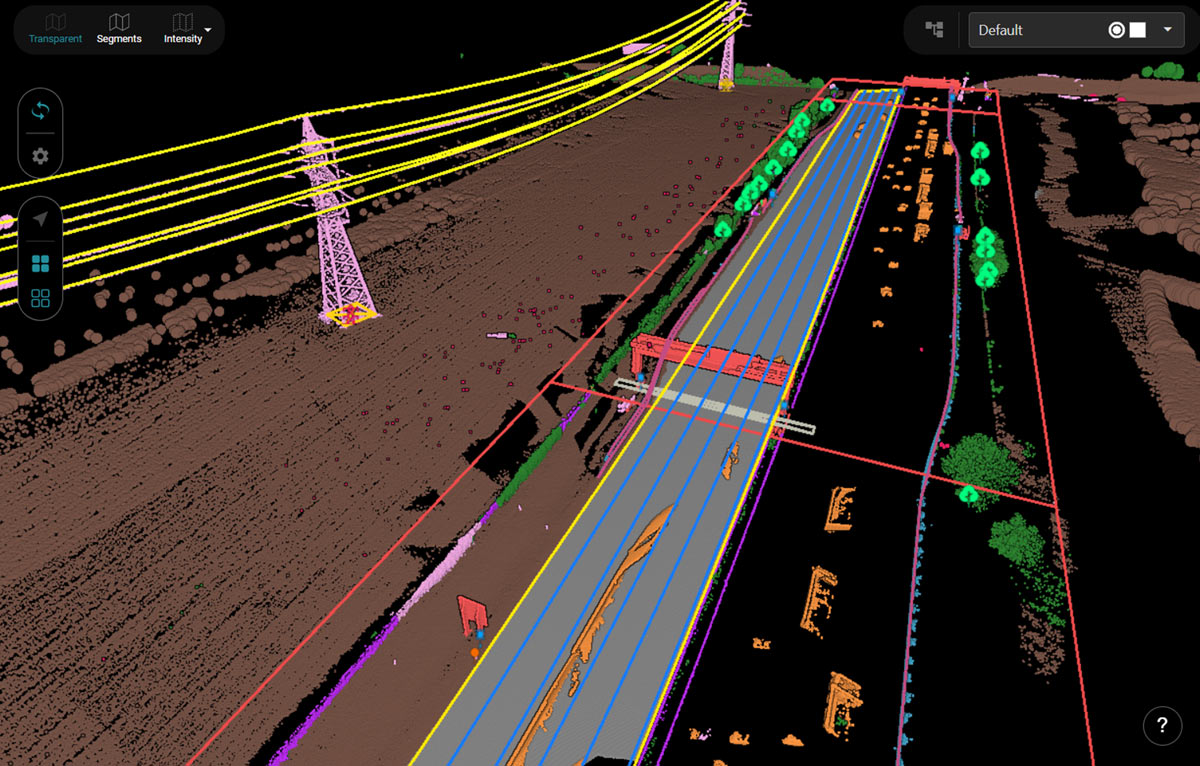
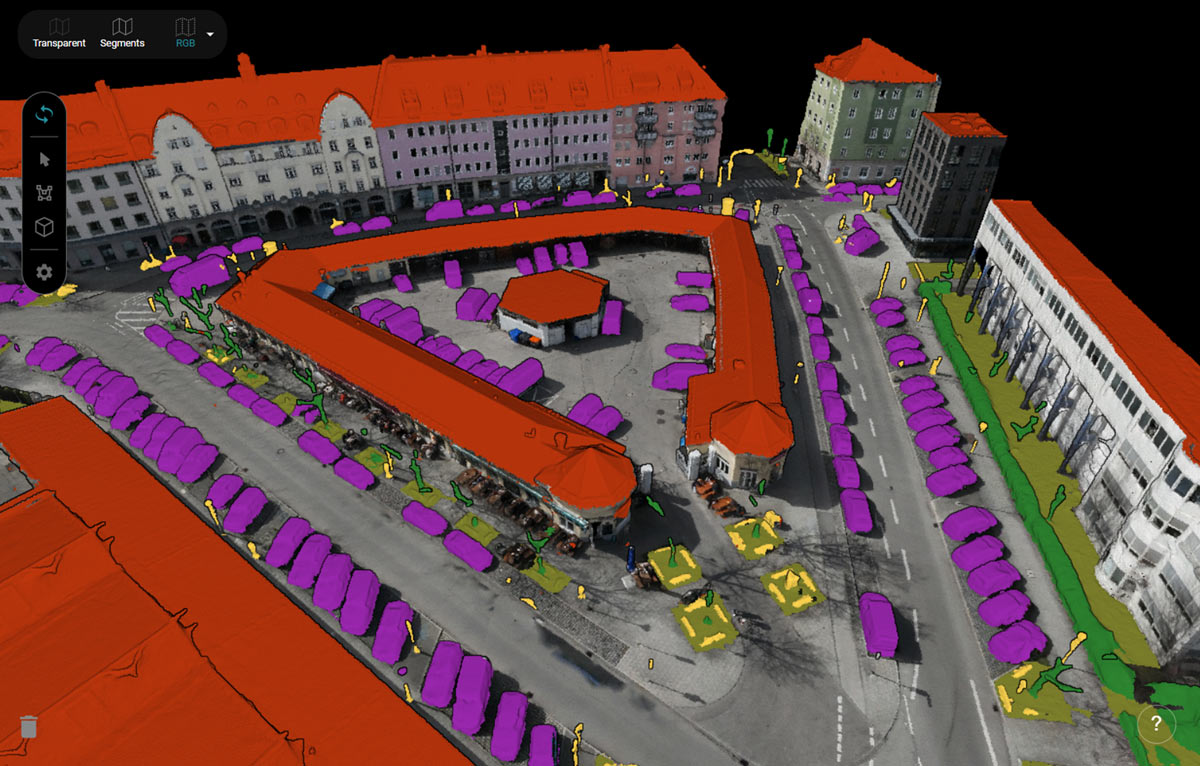
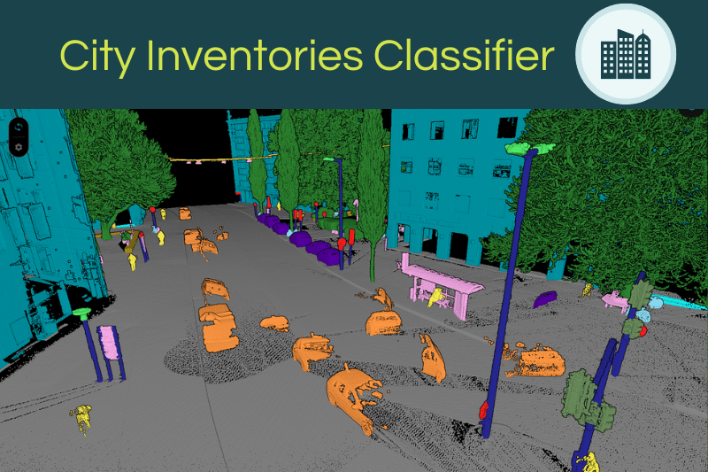
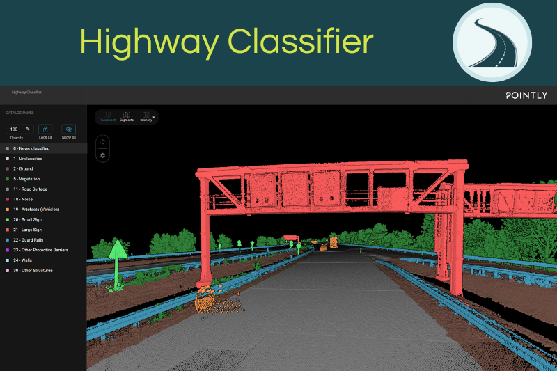
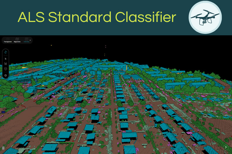
Point Cloud Standard Classifiers.
Pointly offers several Point Cloud Standard Classifiers for various data types and use cases.
Your simple start.
Request a demo of the Pointly platform now.
We’re ready to show you just how easy it is.
Their deep understanding of our needs and goals, as well as their ability to tackle complex challenges with creative and effective solutions, was remarkable. The collaboration was marked by professional and friendly engagement, with communication always open and responsive. Pointly has exceeded our expectations, laid a solid foundation for the further development of our product, and is undoubtedly worthy of recommendation.
Key game changer option is to collaborate with annotators by tagging and commenting on point clouds directly in the 3D view. It solved the issue of endless slides with screenshots and multiple rounds of verifications. It was a pleasure to work with the team!
GeoSpatial Feature Extraction Solutions,
Trimble Inc.
Finally, we could do different vegetation analysis with the data, for example a forest canopy analysis. We are extremely happy with the re-classification results and friendly & fast service of Pointly!
The trained model not only added a lot of information to the current dataset, but also provided a solid basis for applying the model to future aerial surveys.
What used to be a cumbersome process, taking days of manual finetuning for the classifications can now be done in a fraction of the time - with higher consistency and greater accuracy.
The collaboration was exceptionally smooth. Pointly didn't act like a black box - they kept us in the loop throughout development, communicating progress and discussing potential risks transparently. We can confidently say that the results have exceeded our expectations. We look forward to further exploring how this technology can improve our coastal monitoring data workflow.
Project Manager for the Regional Coastal Monitoring Programme
What stands out the most to us is Pointly’s adaptability – the new approach can learn continuously. Thus, any manual correction to the automatic classification (if necessary at all) improves the process for future applications.”


Developed by Experts.
Geo Data Science Technology
made in Germany

This Project is supported by the Federal Ministry for Economic Affairs and Climate Action (BMWK) on the basis of a decision by the German Bundestag.
