Point Cloud Standard Classifiers
published: 07.10.2022
When working with 3D point clouds, it usually takes a lot of effort and time to correctly map your input data. Since assigning classes to objects manually is a laborious task, it is more efficient to automatically map them. Our point cloud Standard Classifiers do exactly that – find out how they work and what they can do in this blog article.
What is a Point Cloud Standard Classifier?
As the name already implies, a standard classifier uses certain presets to automate classification. Thanks to this standardization, you do not have to take care of the entire mapping process by yourself. The service is built on deep learning – a constantly evolving branch of machine learning. By using artificial intelligence through neural networks, we train the point cloud standard classifier to effectively detect certain objects in a point cloud. Next to that, it is geared towards effectively working with different data types such as:
- Airborne laser scans
- Scans by moving vehicles
- Static scans on ground-level
How is a Point Cloud Standard Classifier trained?
In order to automate the process of point cloud labeling without a loss of accuracy, our AI is thoroughly trained. To nurture the point cloud Standard Classification through deep learning, Pointly creates manual input data, which is then repeatedly fed into the classification model. The result? Automatic object classification upon upload of your dataset. You can label complex point clouds way faster than ever before.
How does a Point Cloud Standard Classifier work?
After training it extensively, the standard classifier automatically detects certain classes within point clouds with utmost precision. Depending on your specific project, it helps you to divert your required object class from the remaining points on the point cloud. Thus, receiving a stable base classification, you can work efficiently, saving time and resources.
It should be noted that each point cloud standard classifier is specialized for certain sets of classes. Thus, certain classifiers are better suited for specific uses cases than others when it comes to point cloud standard classification.
Standard Classification for Ground Data with the Pointly Ground Classifier
Pointly’s first classifier is used to extract and classify ground points. As it stands, the ground is rather difficult to classify, as separating it from connected objects proves to be time consuming. Furthermore, the ground generally covers the largest number of points in airborne laser scans.
That is where the Ground Classifier comes into play. Optimized specifically for airborne laser scans, it simplifies the work with elaborate point clouds in several ways:
- It automatically extracts ground points to create accurate models, which are already very useful on their own
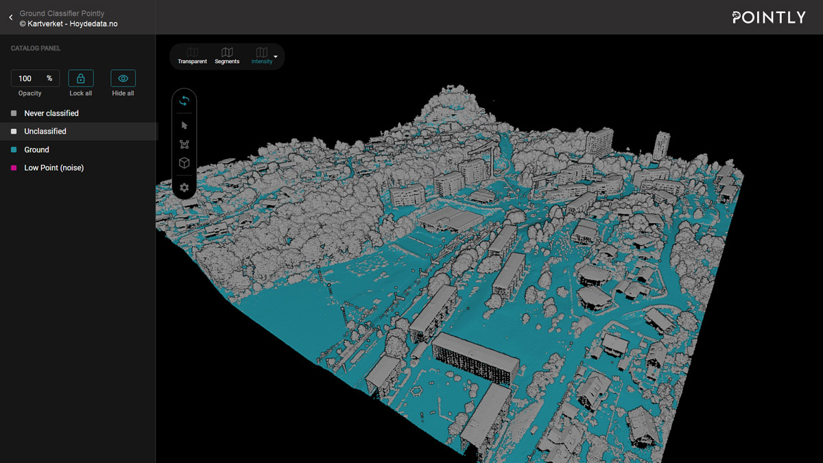
Easily map the ground of your point clouds, including differences in elevation
2. With a clear ground model, you can classify other objects much easier with help of Pointly’s other tools. Locking the already classified ground makes it easy to classify cars, buildings or vegetation with just a few polygons:
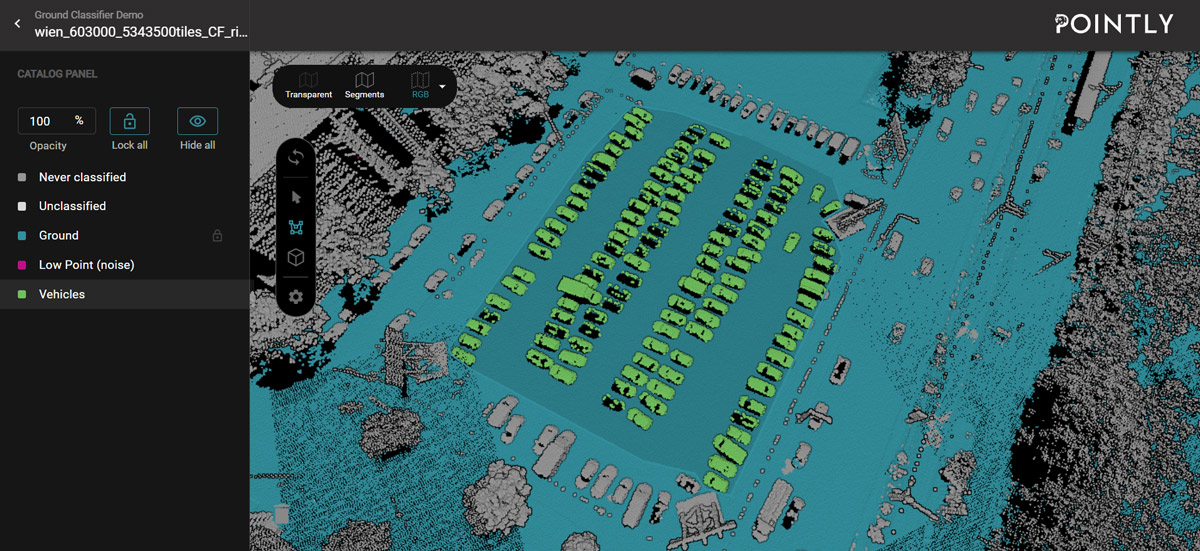
Locking the ground class allows to cleanly label objects such as the cars pictured in green here
How do I use a Standard Classifier?
Working with point cloud standard classification is incredibly easy. Upon uploading, you simply pick the type of classifier you want to apply to your point cloud.
- Upload your LAS or LAZ file into Pointly
- Under “Select Classifier” you choose the type of classifier you want to apply
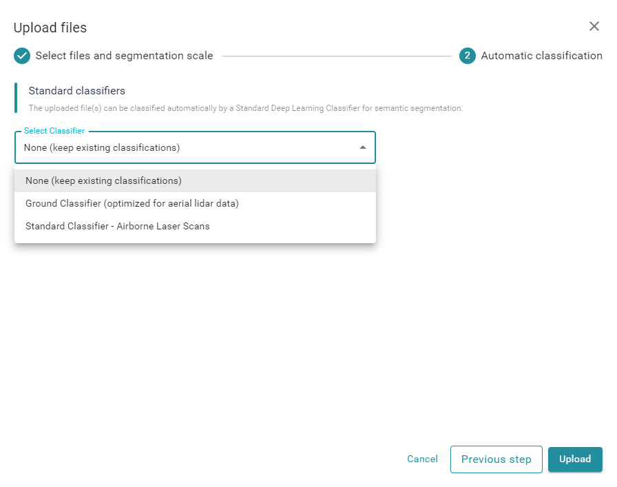
A selection of standard classifiers will pop up
3. By choosing “Add model tag to the uploaded file(s)” you can mark the point cloud with your chosen classifier for easy identification
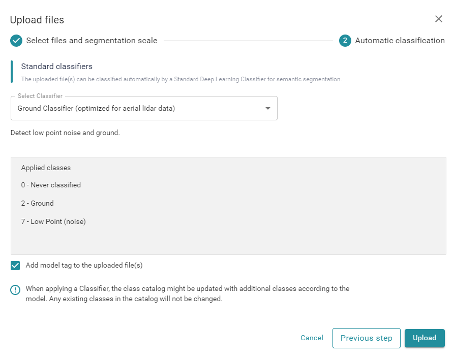
Adding model tags makes it easier to discern different object classes from each other
4. After clicking on Upload, your files will be automatically processed. The duration is depending on the number of points and can take from a few minutes up to 2 hours for very large point clouds (100+ MPoints).
Do you want to automatically classify your point clouds using our trained model? or try a Free Account to convince yourself of Pointly’s efficiency.
More classifiers are on the Way
In general, we can teach classification algorithms to automatically detect any type of desired object, given enough time and input data for training. In fact, further types of standard classifiers are planned already:
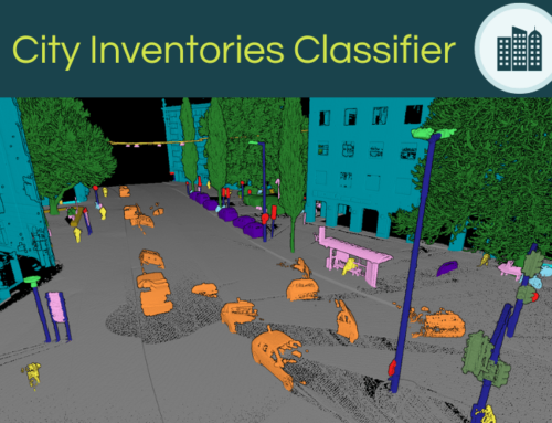
- Detection of buildings and street assets for urban projects or city inventories
- Detection of vegetation in combination with ground data for forestry
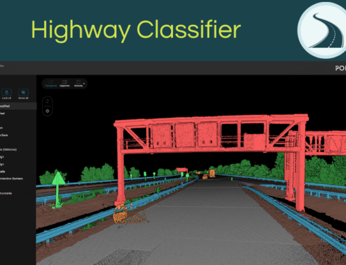
- Detection of vehicles, street assets, and street markings for mobile mapping in cities and on highways
- and many more use cases!
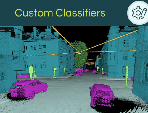
That does not sound like the right classifier for your specific project? Pointly also trains Custom Classifiers with an elaborated AI workflow. Those are further specified Standard Classifiers, which are swiftly adapted to your very needs. As a tailormade solution, the classification is optimized for different data types and custom object classes.
Curious to learn more about upcoming Pointly features? Subscribe to our newsletter and follow us on LinkedIn to learn about updates and more!
Pointly – Point out what matters.
Pointly is an intelligent, cloud-based software solution to manage and classify 3D point clouds – faster and more precise than ever before.
With Pointly Services you can get on-demand advanced 3D point cloud solutions tailormade for you.