

3D Point Clouds in a Nutshell
Answers to 4 “W” Questions that describe 3D Point Clouds and their Status Quo
published: 19.03.2020
W-1: What is a 3D point cloud?
A point cloud is a 3D data set out of n points that have individual measured values. A point usually consists of x, y and z coordinates.
Depending on the scanner type, some point clouds will also provide information about:
- colour
- intensity of the reflected laser beam
- additional information about how the point was recorded.
Among other things, point clouds are created as measurement results of UAV scans, stationary laser scans, robotic control, quality control and satellite based InSAR images. Point clouds can be generated during laser-based distance scanning (LiDAR), from several images (photogrammetry) or with the help of RGB-D cameras.
Point clouds are the most used data type to create a digital twin of real 3D objects. In contrast to 3D data from computer graphics, such as polygons or meshes, point clouds are unordered sets and thus difficult to process algorithmically.

There are several different file formats in which point clouds can exist, where .xyz is the simplest. Here all points are saved as a text file. Further formats are shown in the graphic (right side).
W-2: Who can make use of 3D point clouds?
There is a wide field of users, because the applications of point clouds are diverse. The potential of a 3D point cloud goes by far over virtual site inspections. Hence some examples, where they are a key technology in the digitisation:
- Construction
- Forestry
- Urban and landscape planning
- Mining
- Robotics
- Autonomous driving
- Energy Supply
Point clouds are suitable for prototyping and reverse engineering as 3D models. Moreover, they can be used to survey construction sites and to measure volumes, areas and distances. They enable intelligent navigation in the world, e.g. for robotics and self-driving cars. Besides, point clouds are also utilized for indoor recordings like indoor mapping and the modelling of buildings. Further fields of application are the protection of historical monuments and archaeology, in order to document and analyse finds.
W-3: Why does artificial intelligence play a role for 3D point clouds?
Point clouds require an analysis to obtain valuable information about contained objects and spatial properties. Advances in neural network architectures now allow us to process 3D data directly, combining the analytical capabilities of deep learning with the information richness of 3D point clouds.

Artificial Intelligence (AI) can provide active support to accelerate and automate planning and control processes in the application areas mentioned above in the future. For example, the progress on a construction site can be monitored automatically or the urban infrastructure can be inventoried quickly. Limited 3D analyses can be turned into 3D Big Data analyses in the future.
However, point clouds cannot yet be used automatically. Instead, they are usually evaluated manually or analysed with so-called "unsupervised methods". Here the programmer must manually specify meaningful methods for structure recognition for each application.
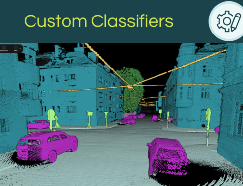
Both approaches scale very poorly with the size of the data sets and only work for limited applications. Therefore, an automated and flexible AI-based solution is desirable. But here is the thing - the AI needs to be trained by example and initially humans need to provide these examples. For this purpose, it must be possible to process the measurement results into training data. This requires a systematic and precise assignment of the individual measurement points to relevant object classes (e.g. building, street, etc.). This process is called "Labelling" in the AI community. In the language of GIS specialists "Labelling" means nothing else but "manual classification".
Though, this is where the bottleneck lies in the area of 3D data analysis, as there are currently no efficient labelling methods that can be applied flexibly to many objects and work on very large point clouds. Most commercially available tools can only handle small point clouds and only allow labelling through bounding boxes. Thus, it is only possible to create the fundamentally necessary training data for AI applications in a very complicated way or not at all.
W-4: When should I start to implement AI strategies for 3D point clouds?
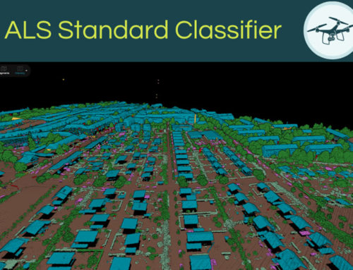
The key to a successful 3D AI strategy is data that can be used to train the AI. For 3D point clouds these are classified point clouds.
However, it is the training data that is the crux of the matter for companies, because large amounts of training data are needed to train a robust AI and classifying is very time-consuming. This is where Pointly comes in with intelligent editing tools that allow training data to be generated faster and easier than before.
With enough training data, the performance of the network becomes so advanced that it can classify new point clouds fully automatically in the future. The larger the data set and the better the quality, the better the performance of the AI that can be trained on it.
The conclusion is that companies which start to collect training data early will be pioneers in the future. On the one hand, because they can make more data available for the AI. On the other hand, because they have been training their AI for a longer period.

Pointly – Point out what matters.
Pointly is an intelligent, cloud-based software solution to manage and classify 3D point clouds – faster and more precise than ever before.
With Pointly Services you can get on-demand advanced 3D point cloud solutions tailormade for you.

Leave A Comment