National mapping
An entire survey, classified to your specification
We fit a classifier to your programme specification and run the whole survey on it: your class catalog, your tile scheme, your delivery windows. Quality control can be taken over and managed by us.
What we do to it
Your catalog, your specification, at programme scale
We have classified ALS for the companies that fly it for years, and that is where the decisions in a workflow come from. We work from a modular training base, trained on datasets from Europe and several other locations worldwide, so fitting a classifier to your class list is measured in hours.
On the Digital Twin Germany programme the line runs at over 5,000 km² in 24 hours, which on that data is up to six terabytes.
The existing training base, tuned to your catalog and your sensors.
The platform starts more machines when jobs queue, so a large survey is a scheduling question.
Quality control against your acceptance criteria, which can be taken over and managed by us.
Objects and key points where the programme needs geometry as well as classes.
On real data
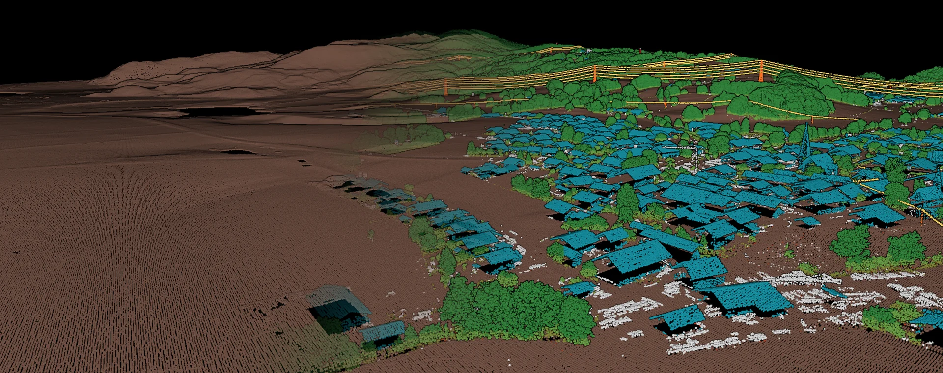
Dense urban areas at full density
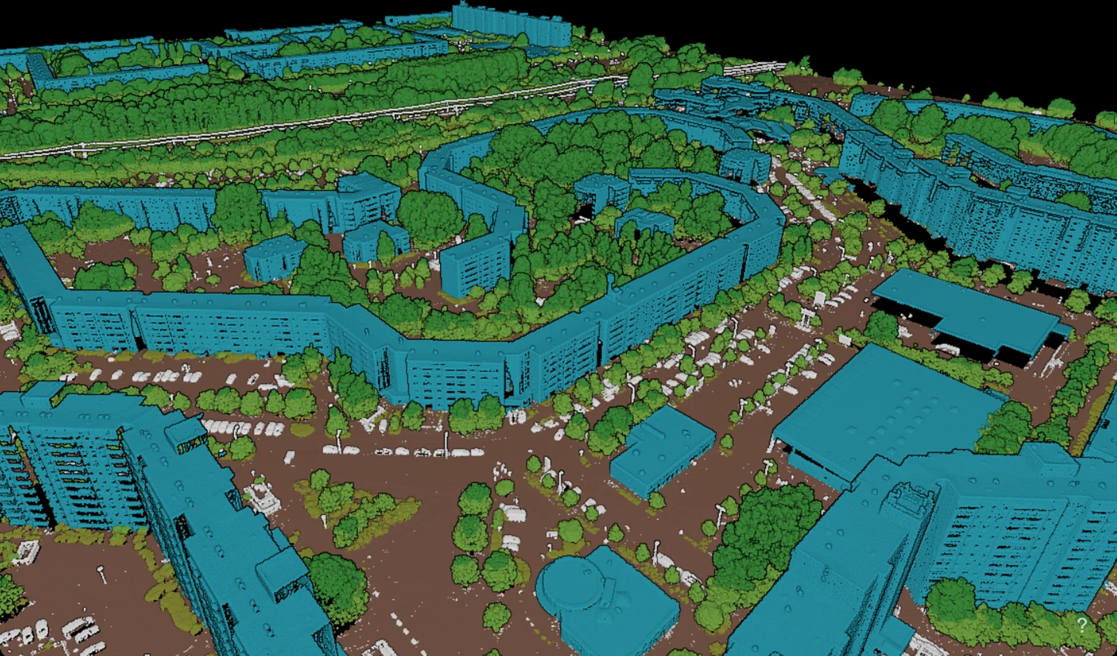
Historic town centres, dense housing and industrial areas are the hardest test for any classifier. We optimise the classifier for the target areas of your survey, so it runs consistently and at scale across every city in it.
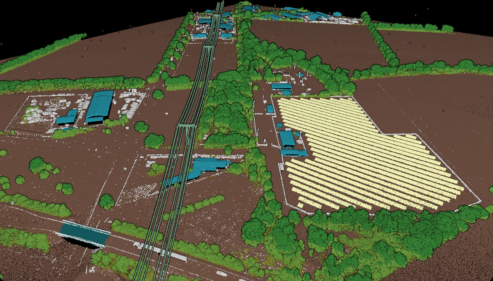
Extraction of complex infrastructure assets
High voltage lines, wind turbines, photovoltaic systems, towers and pipelines, each separated into its own class. The whole area can then be inventoried and analysed as one.
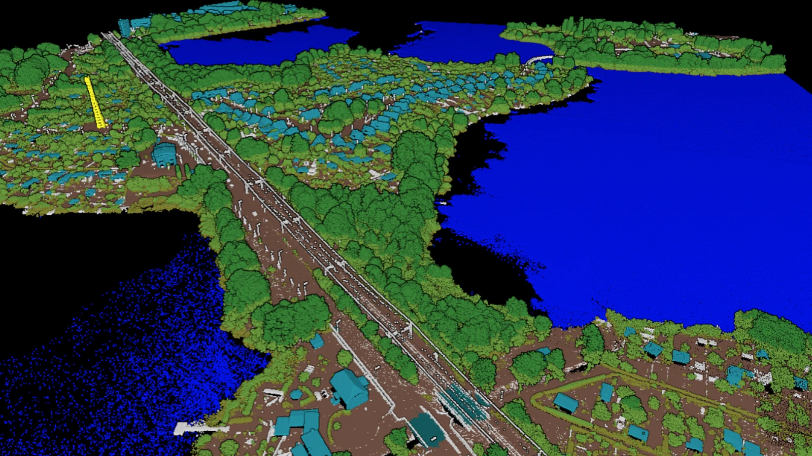
Consistent results across mixed landscapes
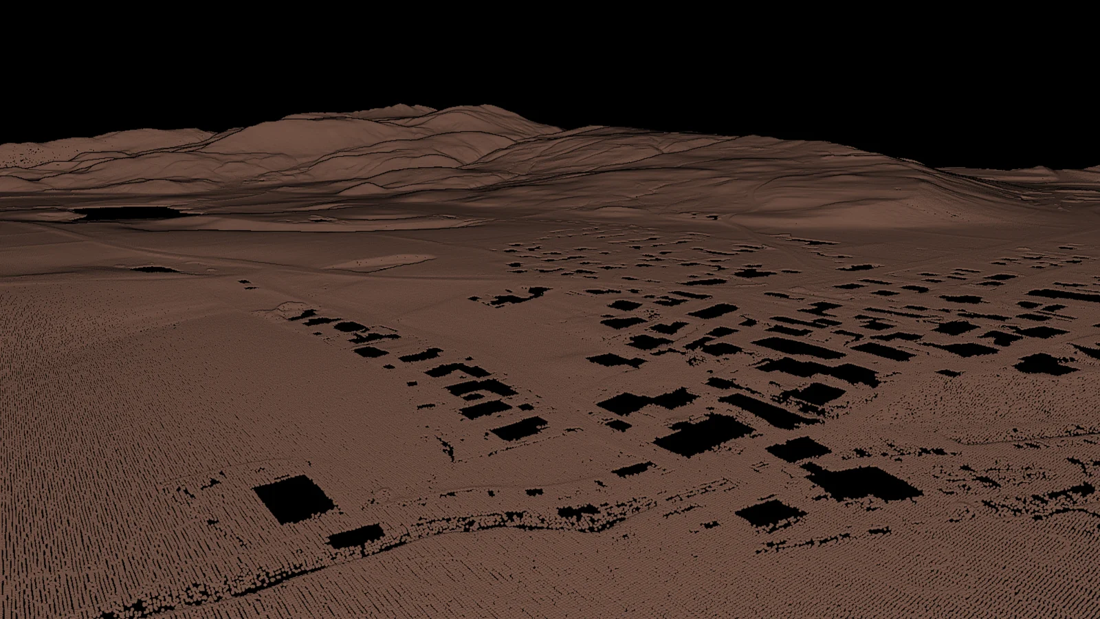
Open water, a railway, a village and the gardens behind it. The same classifier must deliver consistent results across all of them, from the first tile of the survey to the last.
The basis for digital elevation models
Clean ground classification is the key to extracting precise elevation models. A combined approach of industry-proven, macro-based ground classification, enhanced by the output of our AI models, enables the highest level of automation on large-scale projects.
Deliverables
What the survey is for
Every point in your cloud carries a class. Every filter, cleaning step and derived product is built on it.
DTM, DSM and the normalised surface model as rasters on your tile scheme, adapted to your specification.
Canopy height across the survey, out of the classified cloud, for the forestry and biomass parts of the programme.
Ground, buildings, infrastructure and vegetation compared class by class against the previous campaign. That comparison is where a reflight earns its cost.
What lands in your hands
The output
- Airplane
- Helicopter
- Drone
airborne lidar, at programme scale
- LAS
- LAZ
- DXF
- Shapefile
- CSV
- GeoJSON
- GeoTIFF
classified cloud, objects and elevation rasters
Pre-trained Standard Classifier
Our pre-trained Standard Classifier for airborne laser scans, available right away. Test it on your own data at any time with a free account. It was optimized for point clouds with intensity values and average densities of 10 to 50 ppm². If no CRS is specified, the point cloud unit must be meter.
10 classes
recommended
- Intensity
required in the file
IDs follow the ASPRS numbering in the LAS specification. Classes above 18 are ones we added for this catalog.
| ID | Class |
|---|---|
| 2 | Ground |
| 5 | Vegetation |
| 6 | Building |
| 12 | Power Pole |
| 14 | Power Lines |
| 15 | Transmission Tower |
| 18 | Noise |
| 19 | Street Furniture |
| 20 | Vehicles |
| 22 | Other |
This is the starting point for your project. We adapt it to your specification, usually within a day.
Adapted to your project
Custom model training and finetuning for your dataset
We train on your data and tune the model to the specification you work to. Classes get added, split or cut.
Where it runs
On Microsoft Azure inside the EU by default.
A separate tenant in the Azure location your rules require.
The whole stack on your own hardware, air gapped where that is the requirement.
A project like yours
What the client said

“Together with BSF Swissphoto, Pointly worked in a focused manner toward the project goal of achieving a classification accuracy of over 95 %, and developed a tailored workflow that was precisely aligned with the project requirements and target structures.”
See it on your own data
Send us a sample with your project requirements, or open a free account and test our Standard Classifier yourself.
Questions
Before you commit a survey
- How much can you sustain in a day?
On the Digital Twin Germany programme the line runs at over 5,000 km² in 24 hours, on airborne data at roughly 40 points per m². That is up to six terabytes a day. A larger survey runs on more machines and finishes in the same window.
- Can you work to our class catalog and our tile scheme?
Yes. We fit the classifier to your programme specification, your tile scheme and your delivery windows. We adapt the existing training base to a new catalog in hours.
- Where does our data sit while it runs?
Your data sits on Microsoft Azure inside the EU by default, or in a separate tenant in the region your rules require. Where it has to stay on your own network, the same stack runs there as the Pointly Box.