Utilities
From the flight to a corridor model and a cutting list
We turn a corridor flight into the span list your clearance date needs. Every tree measured against the conductor, every tower inventoried, and the calculation behind each number when somebody asks for it.
What we do to it
Classified, vectorized, measured against your threshold
Masts become positions, conductors become lines, and each insulator suspension point becomes a key point on the geometry. The distance analysis runs on that, and what arrives is a span list with a number against every span.
Utilities come to us with a corridor and a date. What varies is the network, transmission or distribution, forested or open, flown or driven. What does not vary is the shape of the job. Separate the wire from what is growing toward it, turn both into geometry, and hand back something a clearance decision can be made from.
The corridor's own classes, with ground and the vegetation tiers included.
Mast positions, conductor runs and insulator suspension points.
A 3D model of the assets, and the distance analysis run on it.
On real data
The corridor, class by class
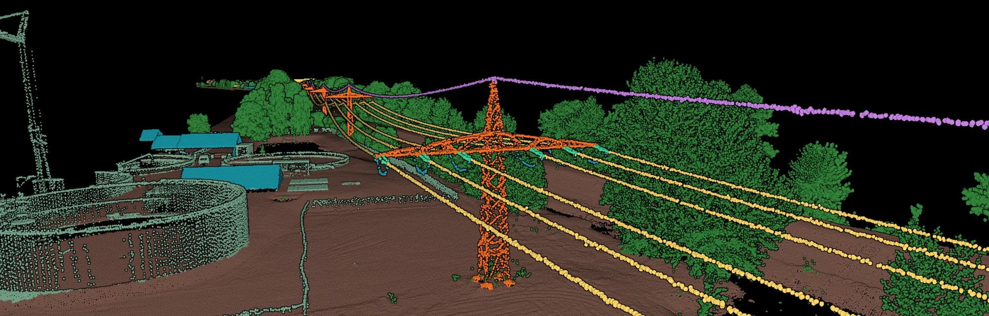
Conductors, shield wire, insulators, towers and the ground under them come back separated, which is what every later step is built on.
Every span as a line, every attachment as a point
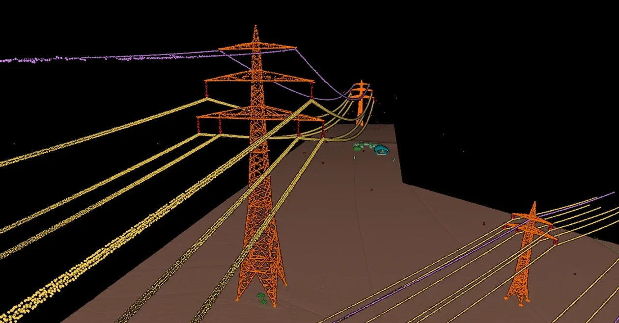
The conductors come back as catenaries, and each suspension point is a node on the line it hangs from. Towers carry their own geometry. That is the model a clearance calculation runs on.
What you know about every span
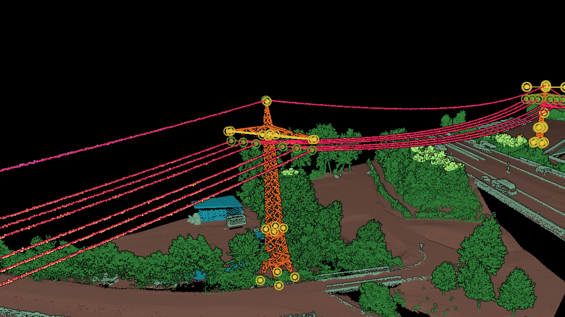
Its length, its sag, the tower at each end and the conductor it belongs to, written on the object itself. A clearance report is built from exactly that.
Vegetation graded by its distance to the wire
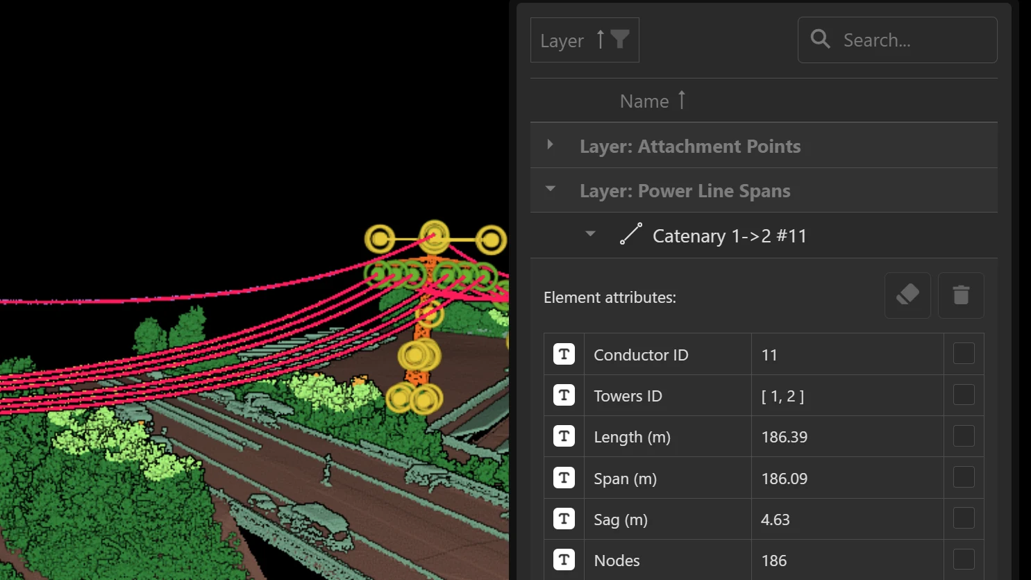
What is inside the threshold comes back as its own classes, banded by how close it is, so the cutting list comes straight out of the survey.
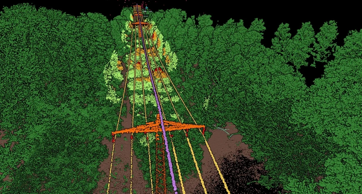
Built for whole networks
The power line classifier runs across whole networks. Customers use it in the platform, through the API and as a managed project, each on a catalog retrained to their own inventory.
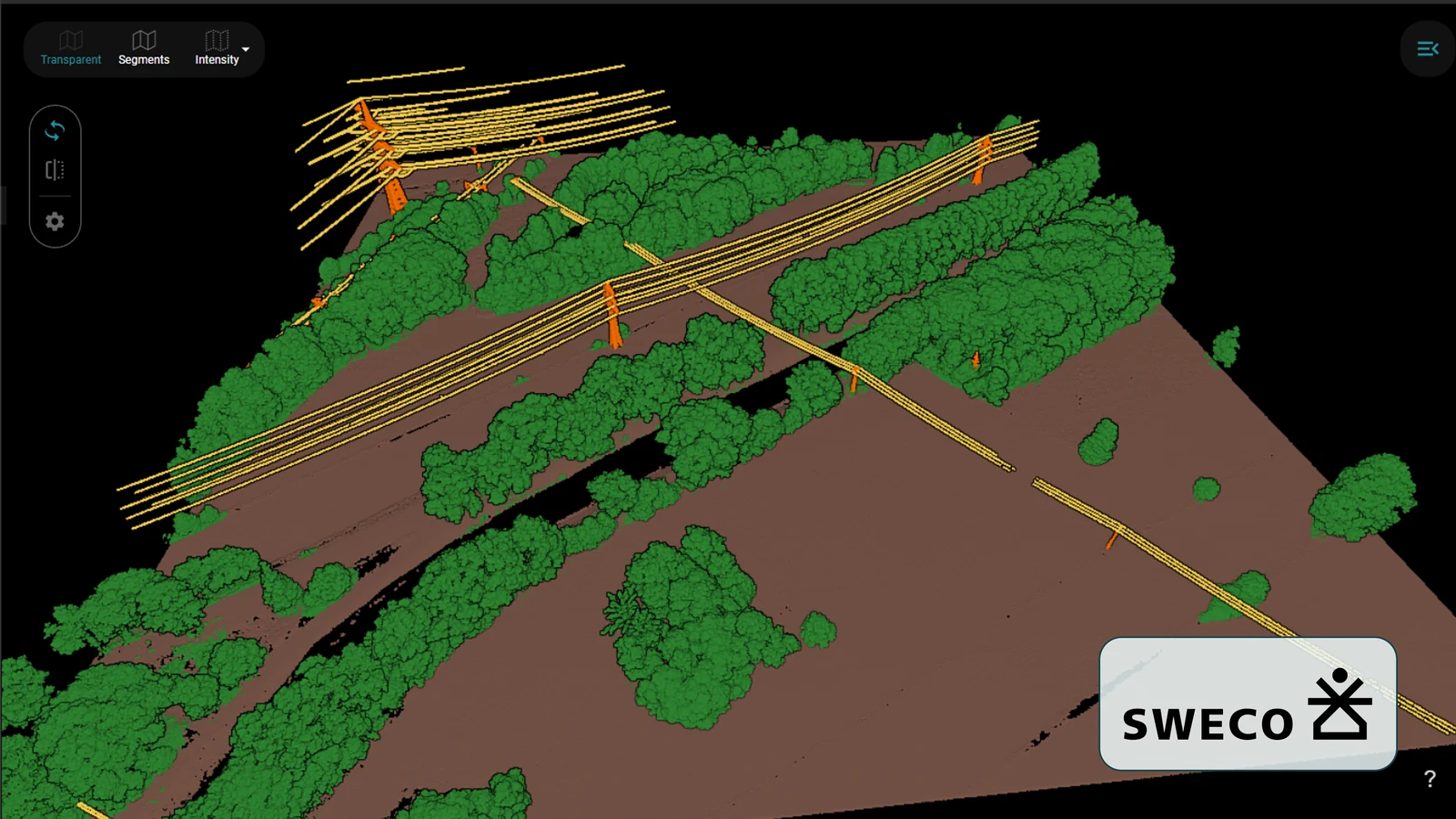
Deliverables
What the survey is for
Every point in your cloud carries a class. Every filter, cleaning step and derived product is built on it.
Every tree measured against the conductor, span by span, back as a pass or a fail with the number behind it.
The spans ordered by severity, so a limited cutting budget goes where it buys the most.
The same corridor from two campaigns compared class by class, which shows where the next breach happens.
The height of the lowest conductor over the terrain, the statutory number and the input a thermal rating needs.
One row per tower, with its position and what is mounted on it.
What lands in your hands
The output
- Airplane
- Helicopter
- Drone
airborne lidar, at large scale
- LAS
- LAZ
- DXF
- Shapefile
- CSV
- GeoJSON
classified cloud and objects
Pre-trained Standard Classifier
Our pre-trained Standard Classifier for airborne laser scans of power line corridors, available right away. Test it on your own data at any time with a free account. If no CRS is specified, the point cloud unit must be meter.
14 classes
recommended
- Intensity
- Return Number
- Number of Returns
required in the file
IDs follow the ASPRS numbering in the LAS specification. Classes above 18 are ones we added for this catalog.
| ID | Class |
|---|---|
| 1 | Unclassified |
| 2 | Ground |
| 3 | Low Vegetation (<2m) |
| 4 | Medium Vegetation (2-5m) |
| 5 | High Vegetation (>5m) |
| 6 | Building |
| 14 | Power Lines |
| 15 | Transmission Tower |
| 18 | Noise |
| 20 | Strain Insulators |
| 21 | Jumpers |
| 22 | Other |
| 23 | Suspension Insulators |
| 25 | Guy Wires |
This is the starting point for your project. We adapt it to your specification, usually within a day.
Adapted to your project
Custom model training and finetuning for your dataset
We train on your data and tune the model to the specification you work to. Classes get added, split or cut.
See it on your own data
Send us a sample with your project requirements, or open a free account and test our Standard Classifier yourself.
Related reading
From the blog
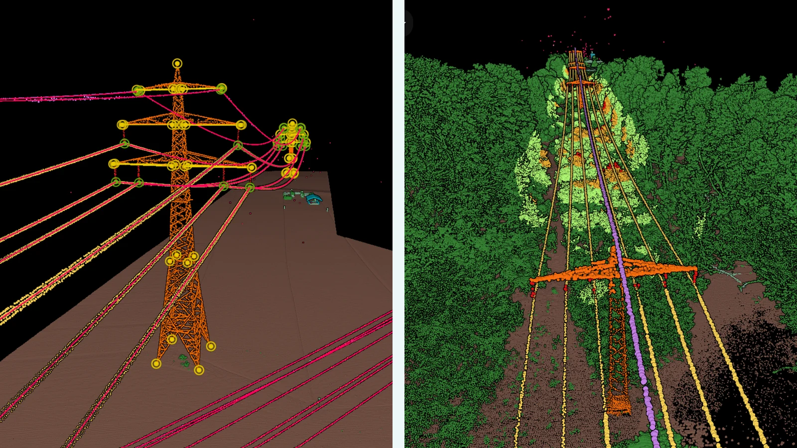
Automatic Powerline Analysis with Pointly
Flying a power line corridor is nearly automatic today. Reading the cloud that comes back is where the hours still go, and that is the part this workflow takes over, from classification through to vectors and encroachment.
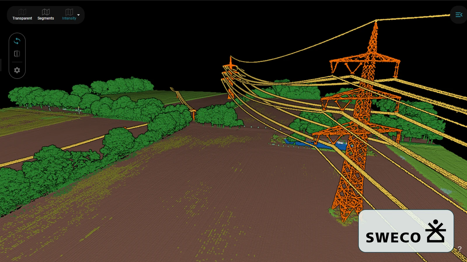
Modern surveying of power line corridors
A corridor survey is only as useful as the classes inside it. What it took to take Pointly's standard airborne classifier and retrain it to SWECO's own catalog, across almost 15 billion points.