Cities
The street scan becomes an asset register
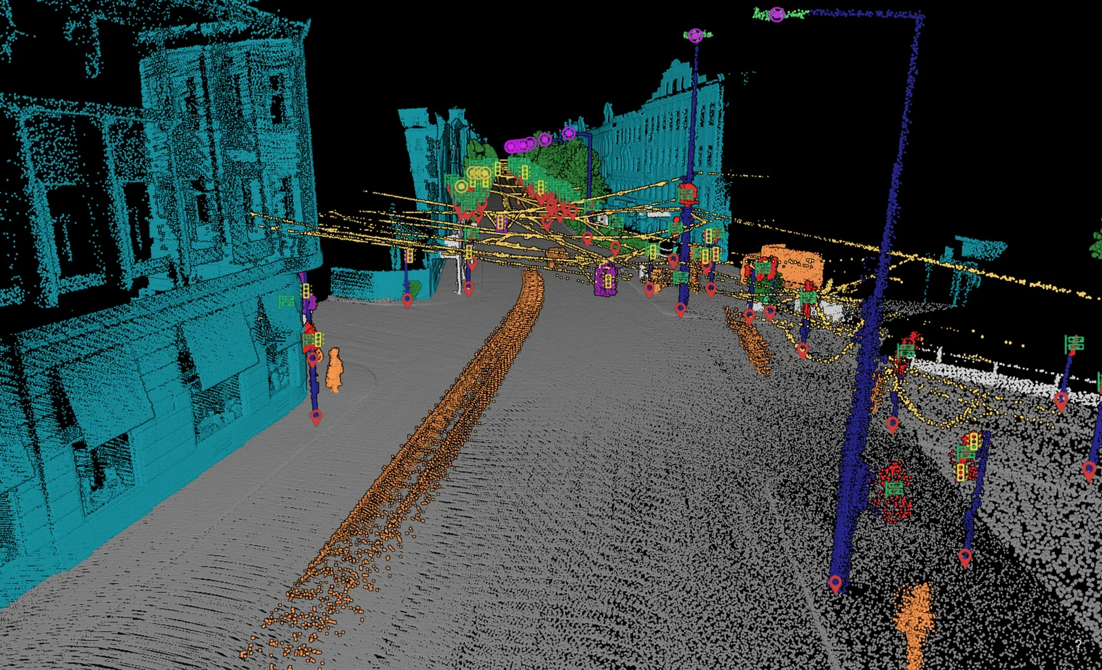
We classify a mobile mapping run of your streets and hand the furniture back as records. Poles, signs, lamps, traffic lights, bollards and bins, each with a position and the columns your register already uses.
What we do to it
Trained on mobile mapping data
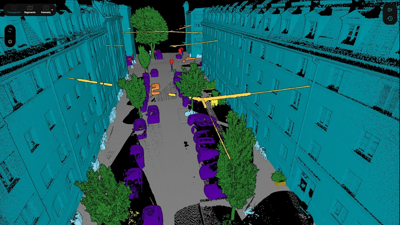
The city classifier learns from ground level scans captured by a sensor on a vehicle, and the classes below are the objects that sensor sees. Rule based steps sit beside the model and settle what geometry answers better, which in a street canyon is a great deal. Out of the classified cloud come the objects: furniture as records, road edges and markings as lines, trees as instances where a programme needs them.
Airborne lidar of the same city runs on the ALS classifier, which learns from data captured from the air. Both catalogs can name the same object. Each model recognises it in the kind of scan it was trained on. See what the airborne classifier covers.
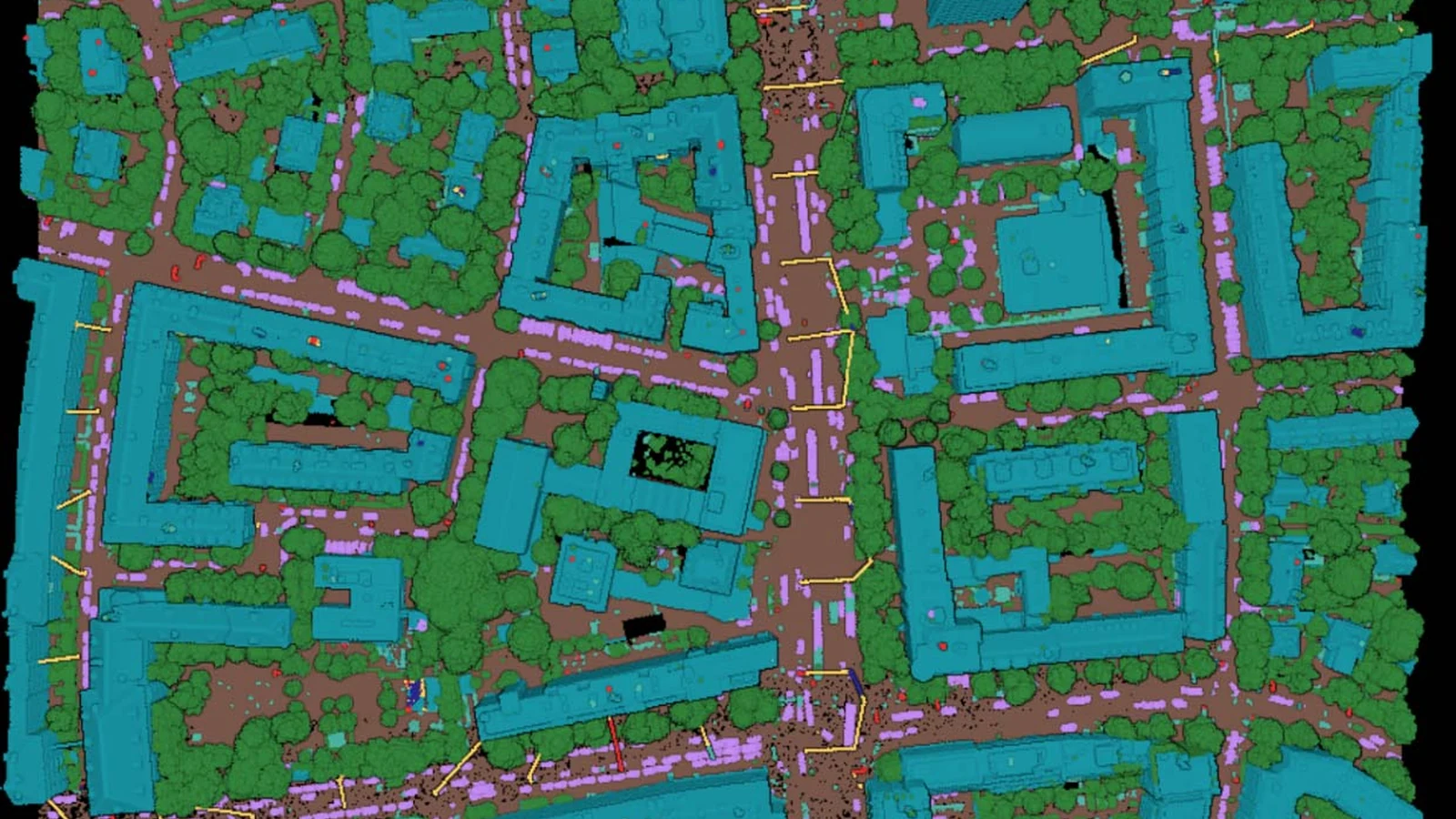
The airborne case has run at city scale. For the City of Munich that was over 2,370 files and 84 billion points, classified in about five days, fetched from the city's own storage and written back into it. Read the Munich project.
The agreed catalog, applied to every street in the run.
Carriageway edges, kerb lines and markings as geometry.
A record per item of street furniture, positioned, ready to join.
On real data
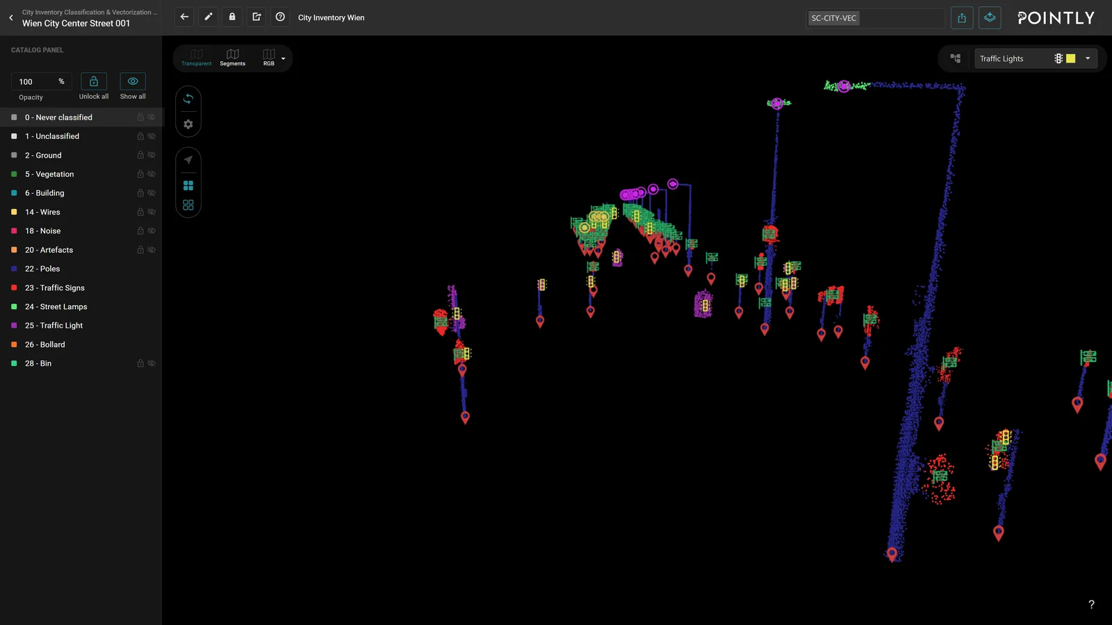
The furniture as objects
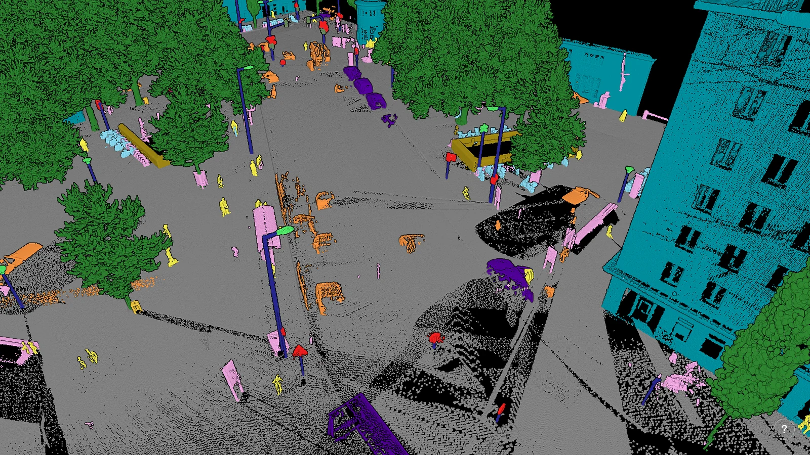
Poles, bollards, signs, lamps and bins are separate classes, which is what turns a capture into a register with a row per asset.
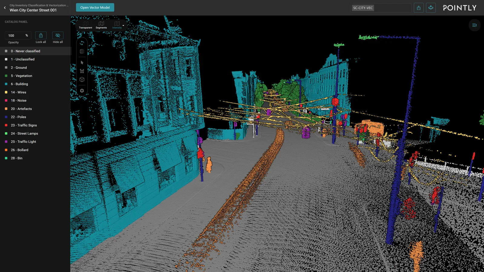
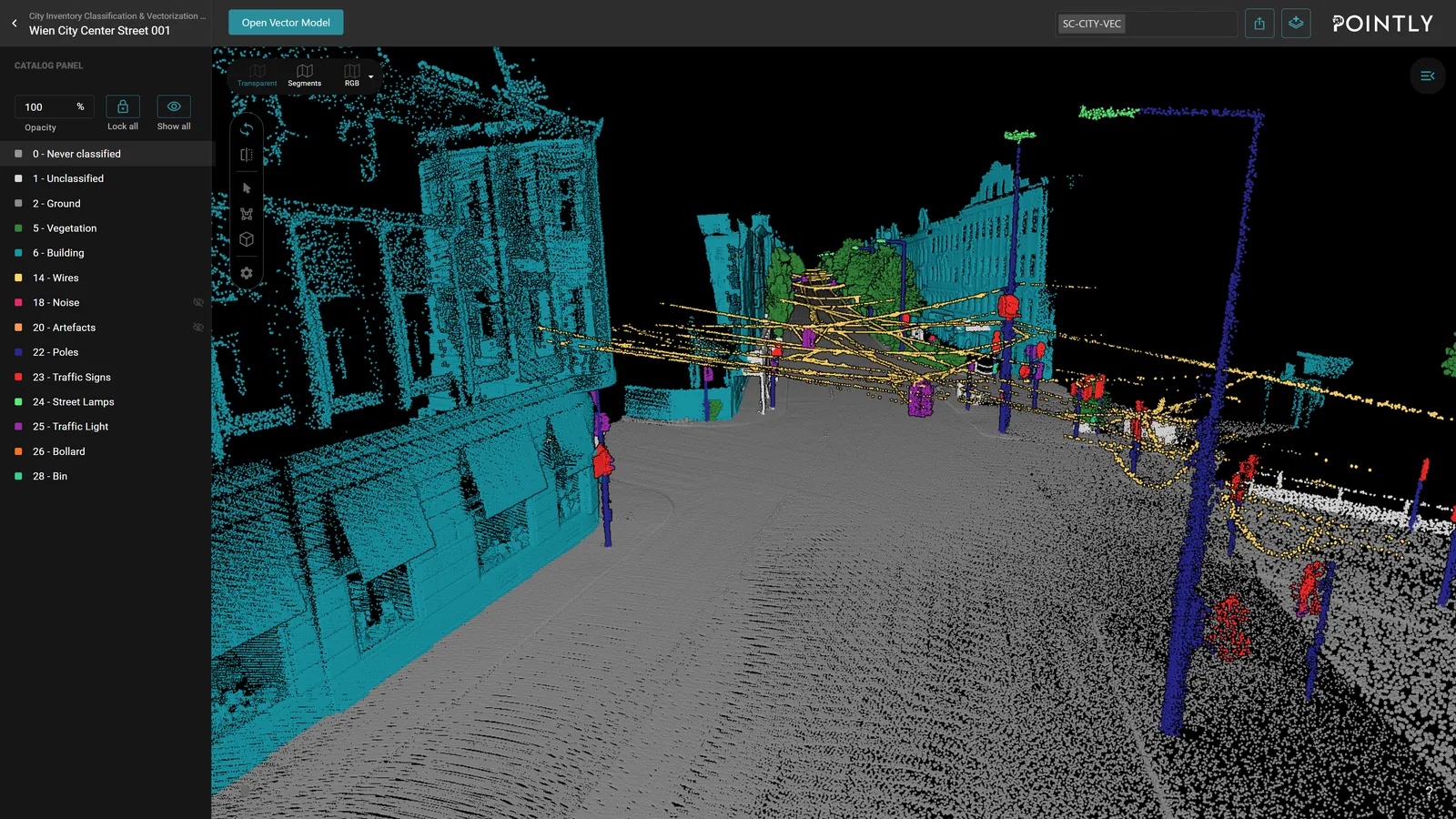
Traffic and people out of the register
Moving artefacts, parked vehicles, bikes and people are classified as what they are, so the inventory shows the street itself.
Every street on the same catalog
A run captured in autumn and one captured next spring come back with the same classes, so the register keeps growing.
Deliverables
What the survey is for
Every point in your cloud carries a class. Every filter, cleaning step and derived product is built on it.
Each tree as its own object, with a position, a height and a crown diameter. That is what you hand over to prove the trees were inspected. The standard catalog carries vegetation as one class, so the instances come from a model trained for that, as project work.
Poles, traffic signs, street lamps, traffic lights, bollards and bins as one record each, with a position, ready to join to the register that already exists. Cabinets and benches are a tuning job on top.
Carriageway edges, kerb lines and painted markings vectorized. Markings are a standard class on the highway classifier and a tuning job on the city one. The kerb is the hard one on both.
The lean is derived automatically and comes back as its own layer. Every pole found, its position, and a configurable criticality level.
Canopy extent and the shade it casts, as a layer. What a heat plan is drawn on, and what shows which streets have none.
Sealed against unsealed across the area, as a layer. A stormwater charge is assessed on exactly that, so the layer pays for itself quickly.
Passers-by, moving cars and scan artefacts taken out, so the register shows the city itself.
Facade lines and footprints derived from the classified cloud, as a starting geometry for a city model.
What lands in your hands
The output
- Survey vehicle
- Tripod
- Drone
- Airplane
mobile mapping first, and the other three on a model of their own
- LAS
- LAZ
- DXF
- Shapefile
- CSV
- GeoJSON
classified cloud and objects
Pre-trained Standard Classifier
Our pre-trained Standard Classifier for ground level mobile mapping lidar, typically captured by a sensor mounted on a car, available right away. Test it on your own data at any time with a free account. It was optimized for point clouds with high point densities and intensity values.
13 classes
recommended
- Intensity
required in the file
| ID | Class |
|---|---|
| 1 | Unclassified |
| 2 | Ground |
| 5 | Vegetation |
| 6 | Building |
| 14 | Wires |
| 18 | Noise |
| 20 | Artefacts |
| 22 | Poles |
| 23 | Traffic Signs |
| 24 | Street Lamps |
| 25 | Traffic Light |
| 26 | Bollard |
| 28 | Bin |
This is the starting point for your project. We adapt it to your specification, usually within a day.
Adapted to your project
Custom model training and finetuning for your dataset
We train on your data and tune the model to the specification you work to. Classes get added, split or cut.
A project like yours
What the client said

“With this classifier, a fully automated classification for the entire city of Munich was realized in a very short time.”
See it on your own data
Send us a sample with your project requirements, or open a free account and test our Standard Classifier yourself.
Related reading
From the blog
Introducing Pointly's new Mobile Mapping Classifier for city inventories
A standard classifier for mobile mapping scans of a city, trained on datasets from Germany and Austria: the surfaces, the street furniture, the vehicles and the people, each in its own class.
Proving Pointly's scalability: classification of an entire major city
Over 2,370 files and 84 billion points, the aerial lidar of a whole city, run in about five days out of the customer's own storage and back into it.