Rail
Mast, wire and rail, each as its own object
We hand the corridor back with every point classified and the objects built out of it: masts as positions, the overhead line as geometry, and one row per asset ready for the register.
What we do to it
Classified, vectorized, and one row per asset
The model reads the scene and rule based steps correct it wherever the geometry of a corridor answers more reliably, which along a track is often. We agree your object catalog before anything runs at corridor scale, then tune an existing training base to it.
For Digitale Schiene Deutschland the second iteration reached up to 95 to 98 % on the well represented classes of its validation set. The classes introduced in that iteration landed below it. A class with training data behind it lands well, which is why the catalog is agreed before the corridor runs. Read the Digitale Schiene Deutschland project.
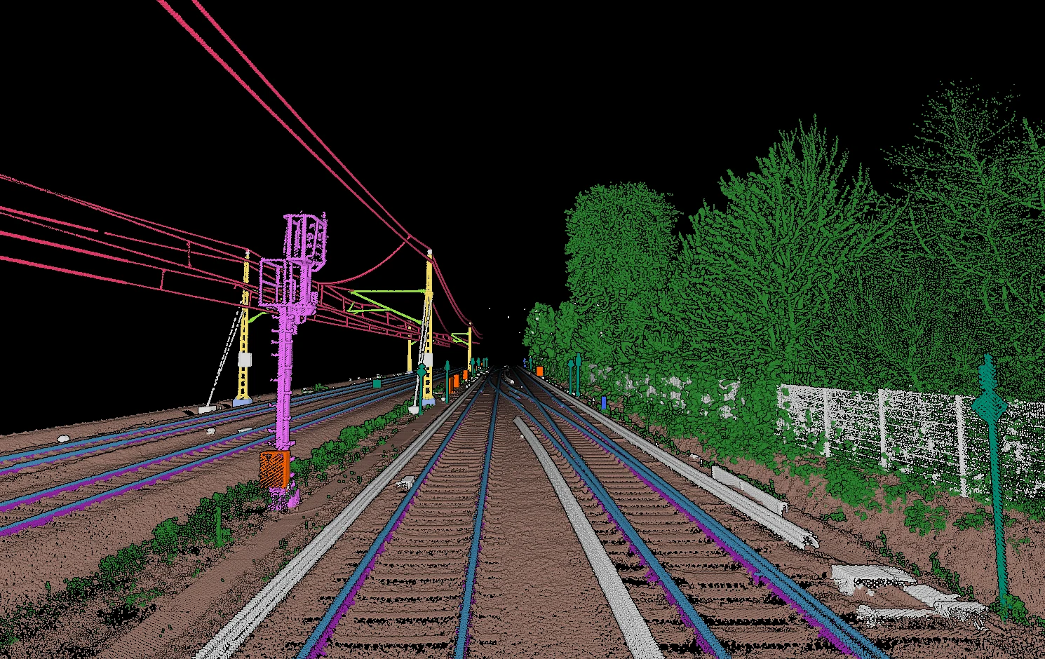
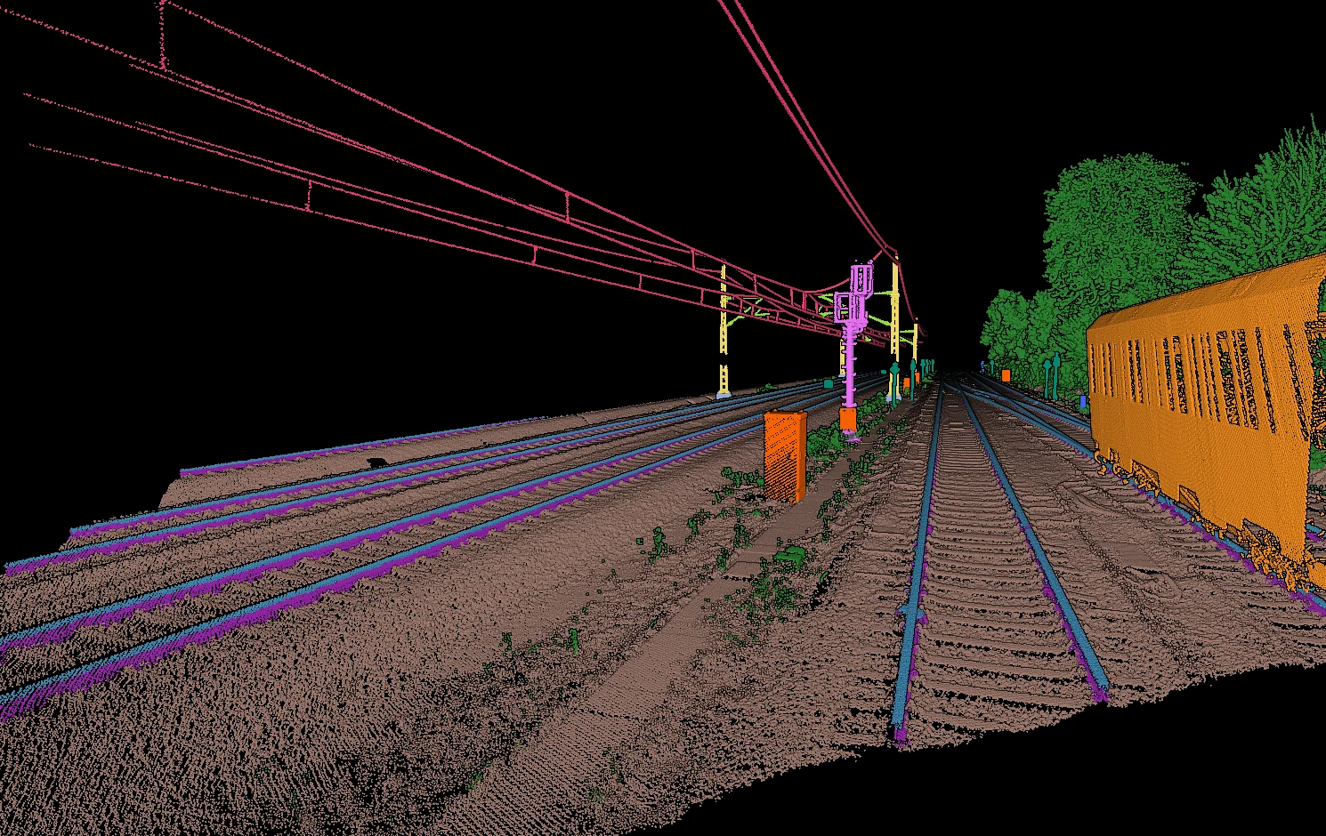
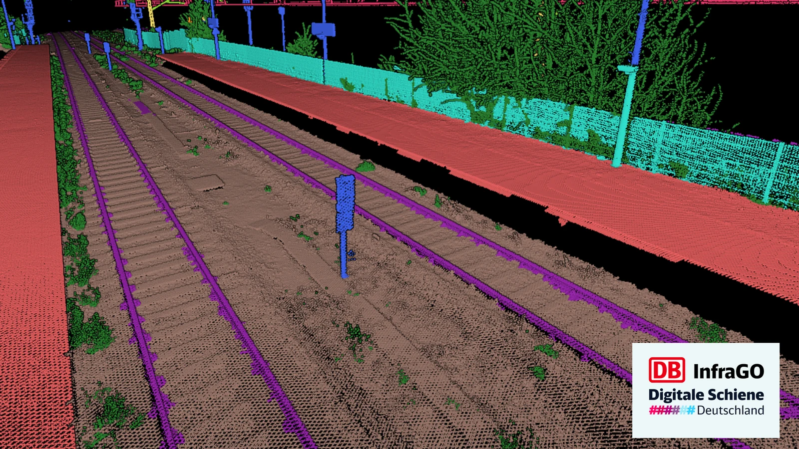
Every point in the corridor carries a class, ground and track bed included.
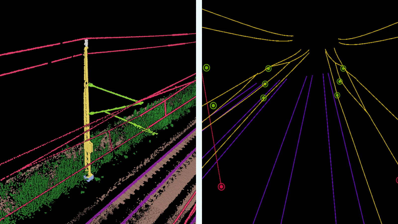
The objects those classes describe, as geometry.
One row per asset, with its position, ready to join to the register.
On real data
The catenary comes off the mast
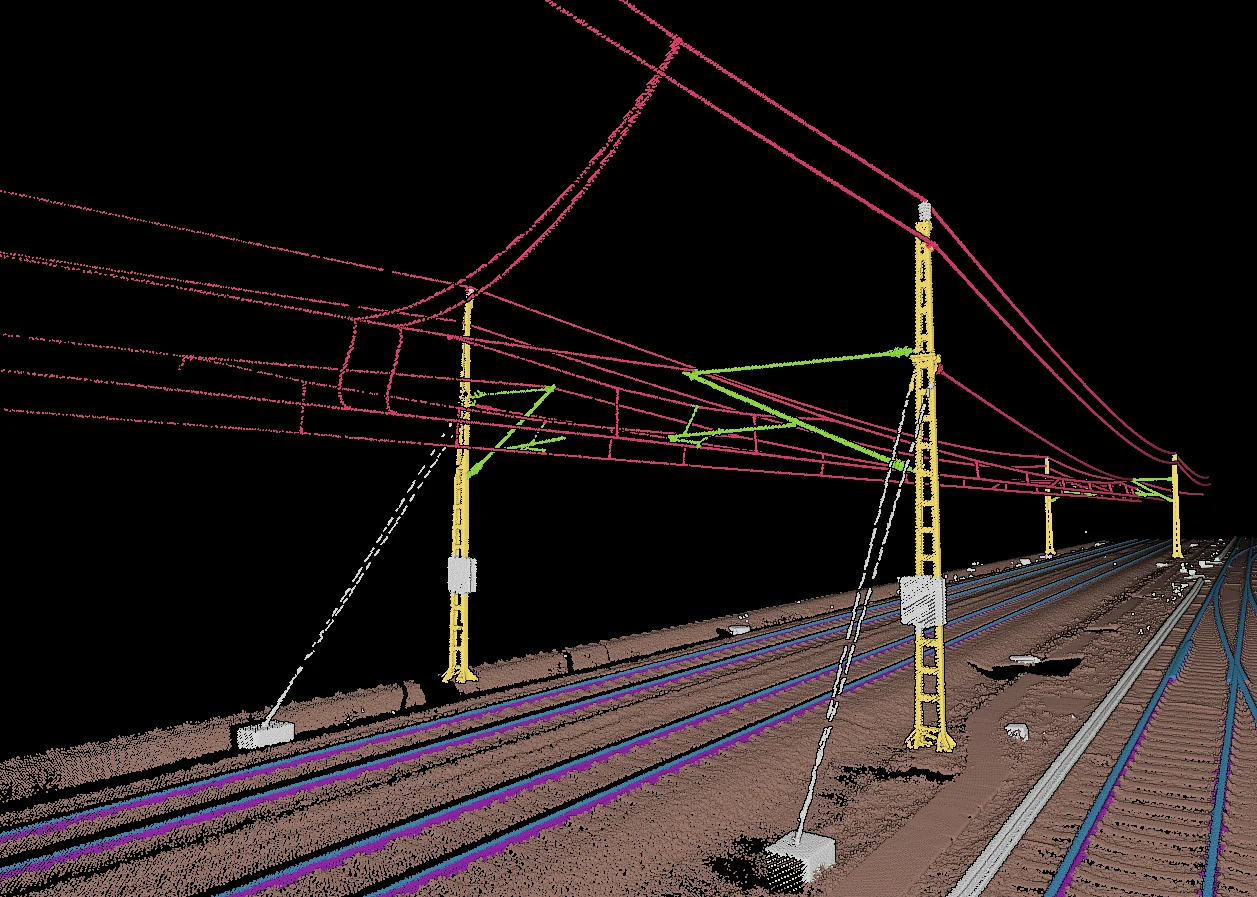
Rails, top rails, catenary poles, their extensions and the wires between them are separate classes, so the corridor can be read object by object.
Custom feature extraction
The classifier is trained on the distinctions your specification names. Here the top rail carries a class of its own, separated from the rail beneath it along the whole corridor.
The mast and the wires become geometry
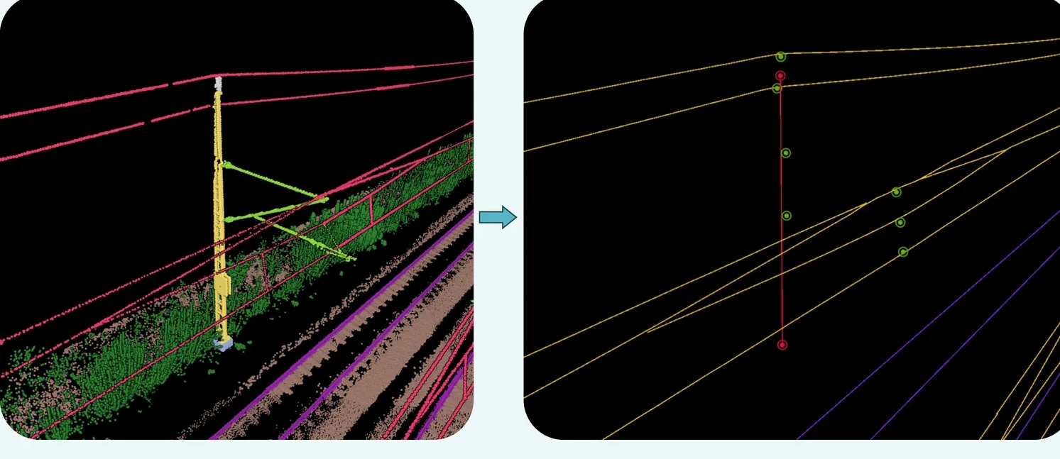
Each catenary pole comes back as a line with its anchor points on it, and each wire as a line of its own. Those are the BIM-ready vectors a model gets built from.
Deliverables
What the survey is for
Every point in your cloud carries a class. Every filter, cleaning step and derived product is built on it.
Every point held against the clearance envelope along the track, so what comes back is the list of places that foul it.
The track center line and the rail pair as vectors, which is the reference the alignment and maintenance systems downstream are built around.
Distance from the vegetation to the track and to the overhead line, section by section, so the cutting plan comes out of the same run.
Catenary runs and mast positions as an inventory, ready to join to the electrification register.
One row per asset with a position, in the format the register accepts.
What lands in your hands
The output
- Measurement train
- Airplane
- Drone
- Tripod
mobile mapping, airborne and terrestrial lidar
- LAS
- LAZ
- DXF
- Shapefile
- CSV
- GeoJSON
classified cloud and objects
The class catalog
Detect various objects along the rail infrastructure on mobile mapping Lidar data with an extended catalog. The model was optimized for point clouds with intensity values.
17 classes
recommended
- Intensity
required in the file
| ID | Class |
|---|---|
| 1 | Unclassified |
| 2 | Ground |
| 5 | Vegetation |
| 10 | Rail |
| 11 | Top Rail |
| 14 | Wires |
| 19 | Train |
| 20 | Catenary Poles |
| 21 | Extensions |
| 22 | Other Pole Objects |
| 23 | Platform (stations) |
| 24 | Noise Protection Walls |
| 25 | Fundaments (Catenary Poles) |
| 26 | Fuse Box |
| 27 | Sign Poles |
| 28 | Signal Poles (Normal) |
| 29 | Signal Poles (Large) |
This catalog belongs to the classifier trained for DB InfraGO on their own measurement train data. It stands here as an example of the shape a rail catalog takes. Your corridor gets a classifier trained on your data and your catalog.
Adapted to your project
Custom model training and finetuning for your dataset
We train on your data and tune the model to the specification you work to. Classes get added, split or cut.
A project like yours
What the client said

“Despite challenging data conditions, Pointly delivered impressive results with their AI-based classification more quickly than anticipated.”
See it on your own data
Send us a sample with your project requirements for us to evaluate.
Related reading
From the blog
From Point Cloud to BIM Model: AI-Based LiDAR Processing in the Railway Sector
Mobile laser scanning captures a railway corridor in a single run. What turns that run into a BIM model is the classification and the object extraction in between, and both of them are automated.
Successful collaboration with Digitale Schiene Deutschland: training and deployment of a custom classifier with Pointly
Two iterations of a custom classifier for railway track, the second one built to tell a top rail from the rail under it and to keep vegetation out of the overhead lines.