Digital Twin Germany: over 63,000 km² classified automatically
5 min readNational mapping, Projects
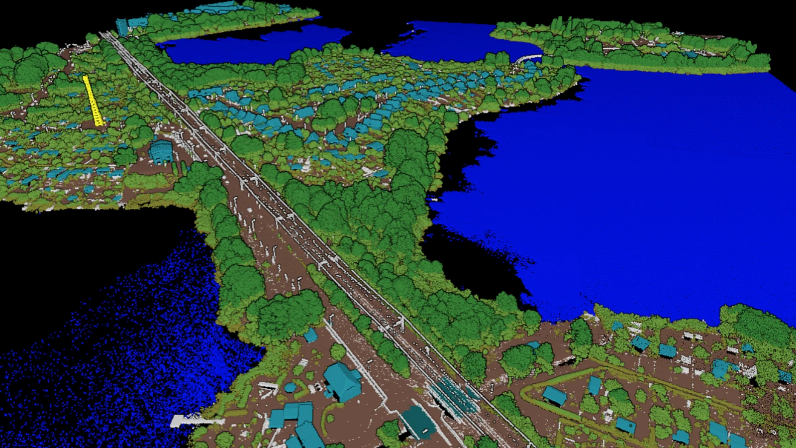
Over 63,000 km² of airborne lidar, over 4.5 trillion points and a class catalog that had to carry high voltage overhead lines, wind turbines and photovoltaic systems alongside the usual terrain and buildings. The classification is finished.
A country is not flown in one season. The Federal Agency for Cartography and Geodesy is building a lidar record of the whole federal territory, roughly 356,794 km², and it contracts the work area by area. One of those areas runs over several flying campaigns and several years, against a specification that does not move once it is set.
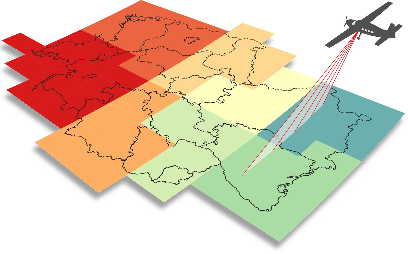
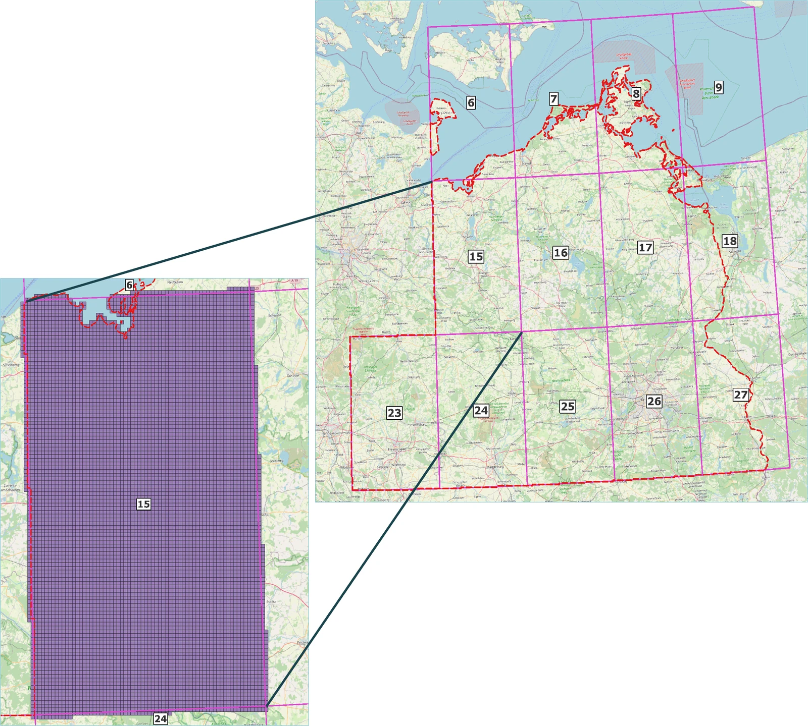
What makes an area like this hard is not its size on its own. This one covers Mecklenburg-Western Pomerania, parts of Brandenburg and the Baltic Sea islands, so one classification workflow has to hold over open water, coastline, farmland, forest, small towns and industrial sites. A classification that is excellent on the demonstration tile and uneven two blocks later costs a programme its schedule, because the next campaign is already in the air.
One workflow, built for this catalog
BSF Swissphoto flew Lot 2 and ran its production. Pointly classified it. The workflow was built for this catalog, and that is what decides whether the manual work at the end is a week or an afternoon.
Deep learning models do the work wherever the shape of an object is the evidence. Rule based steps sit beside them and take the decision wherever geometric context is the more reliable witness, which on a national dataset is more often than a purely learned pipeline would like. Several training iterations ran against tiles the project team chose, including the ones they already knew were difficult, and each iteration moved the result closer to a classification that needs only minimal manual post processing. The accuracy target was set at over 95 % at the start of the project and it was reached.
All of it ran through the Pointly API inside BSF Swissphoto's own production pipeline, so the classification was one step in their own process.
What the catalog had to carry
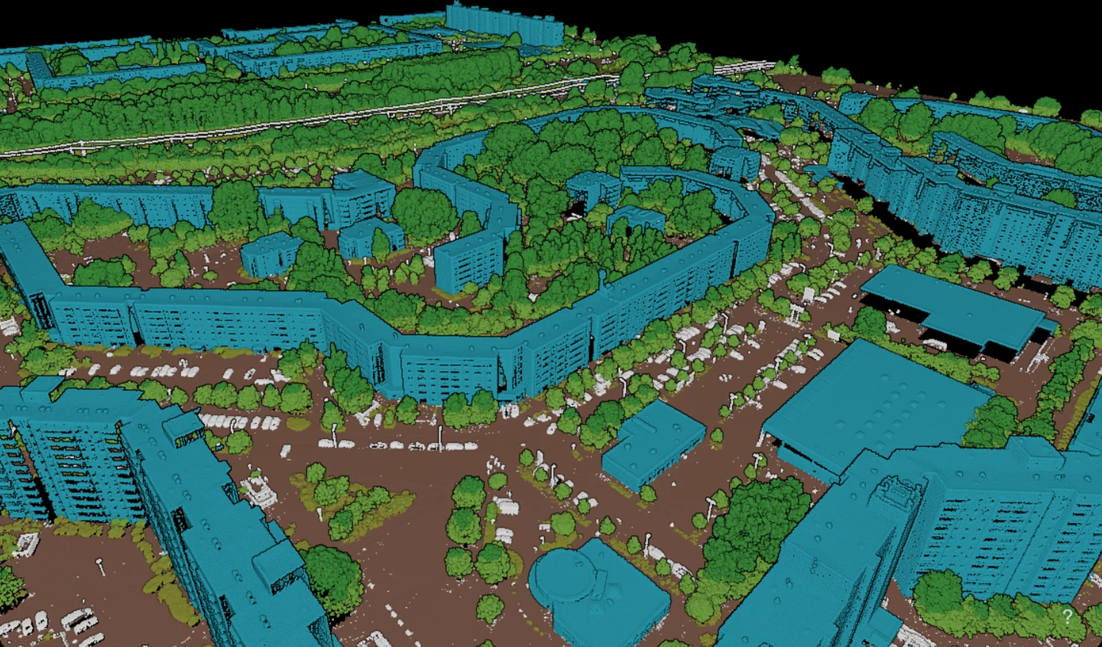
Terrain, vegetation and buildings are the base of any national catalog. This one also carried the above ground objects that make a digital twin useful to the people who operate infrastructure: high voltage overhead lines, wind turbines and photovoltaic systems, towers, pipelines and the rest of what stands in the open. Each one is a shape the model has to find in a scene full of things that look similar to it. A photovoltaic field is a plane at an angle a few centimeters above another plane, and a conductor is a thin catenary with almost no points on it.
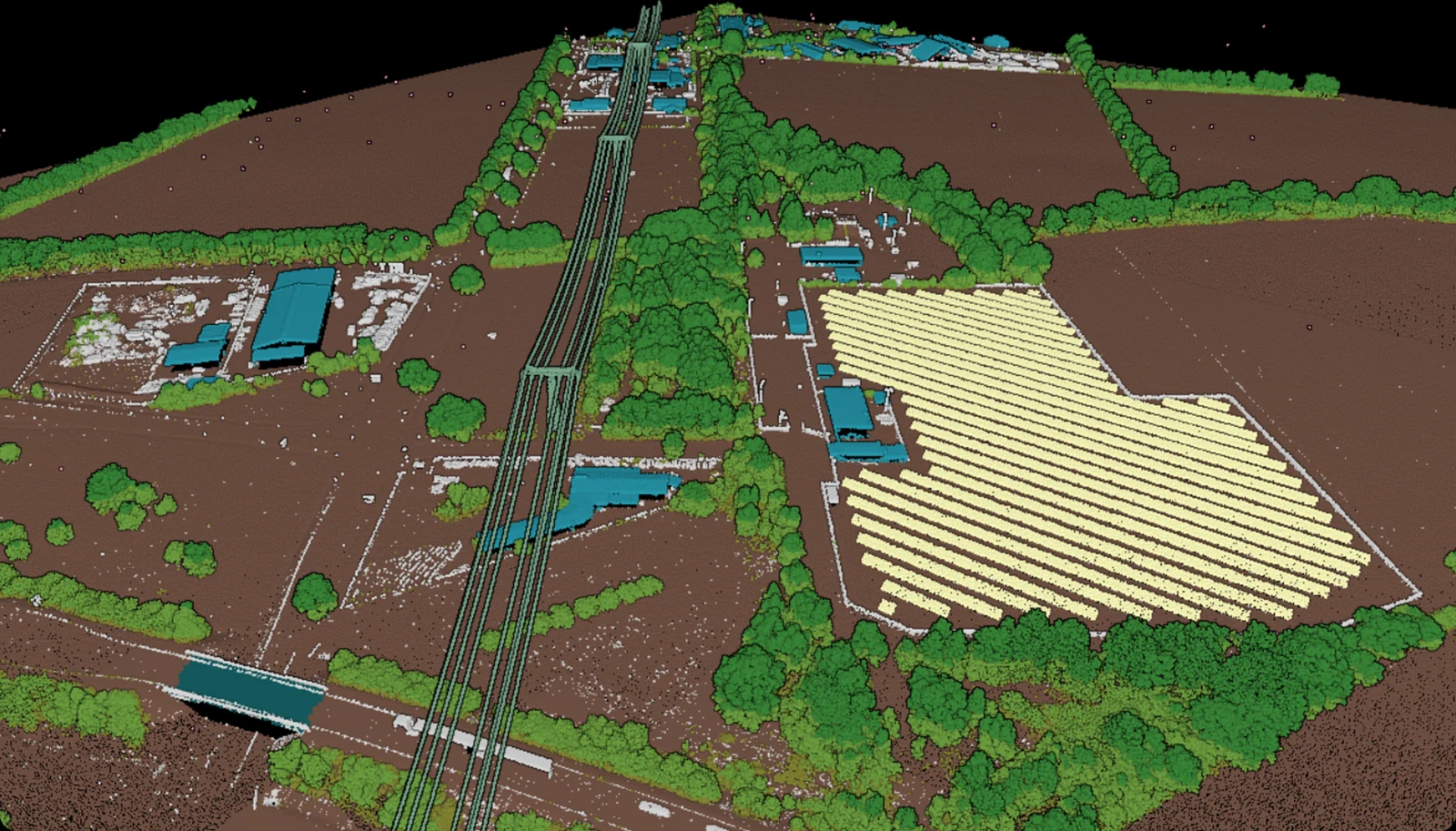
The capture specification for the programme is roughly 40 points per m². The territory is divided into blocks, one degree of the projection cut to the national border, so no two blocks are the same size and a full one runs to somewhere between 7,000 and 8,000 km².
The numbers the line settled at
Throughput ended up at over 5,000 km² in 24 hours, which on this data is up to six terabytes in the same window. That is the figure that decides whether an area this size is a scheduling question or a capacity one, and it is why the agreed dates held through every campaign.
Across the whole target area that adds up to over 63,000 km² classified and over 4.5 trillion points, at over 95 % accuracy.
Together with BSF Swissphoto, Pointly worked in a focused manner toward the project goal of achieving a classification accuracy of over 95 % and developed a tailored workflow that was precisely aligned with the project requirements and target structures. The project was demanding and included a complex class catalogue with special classes such as high voltage power lines, wind turbines and solar panels.
Within the first months of production, more than 30,000 km² were processed reliably. Pointly proved to be a dependable partner throughout this phase.
We continue to work together on the ongoing project as well as on additional initiatives and are building a long term partnership for highly accurate and scalable point cloud processing.
 Jörg WertliCEO, BSF Swissphoto
What we would say to the next programme
Two things carried this project, and neither of them was the model on its own.
The first is that the classifier adapts to the programme's catalog, not the other way round. We work from a modular training base, so fitting a classifier to a catalog it has not seen is measured in hours. What has to match is the objects a programme needs and the specification it has written for each one, and both of those stay the programme's own.
The second is that we have been doing this with surveying companies for years, which is where the workflow decisions come from. Where a rule beats a model, how a block gets sampled for training, what the post processing has to catch: none of that is in a specification, it comes from experience. Where a project needs the quality control as well, we take that on and manage it end to end.
The idea behind this, written up before the programme ran, is in AI meets geo data.
Read more about National mapping.
Read next