From Point Cloud to BIM Model: AI-Based LiDAR Processing in the Railway Sector
1 min readRail, Knowledge
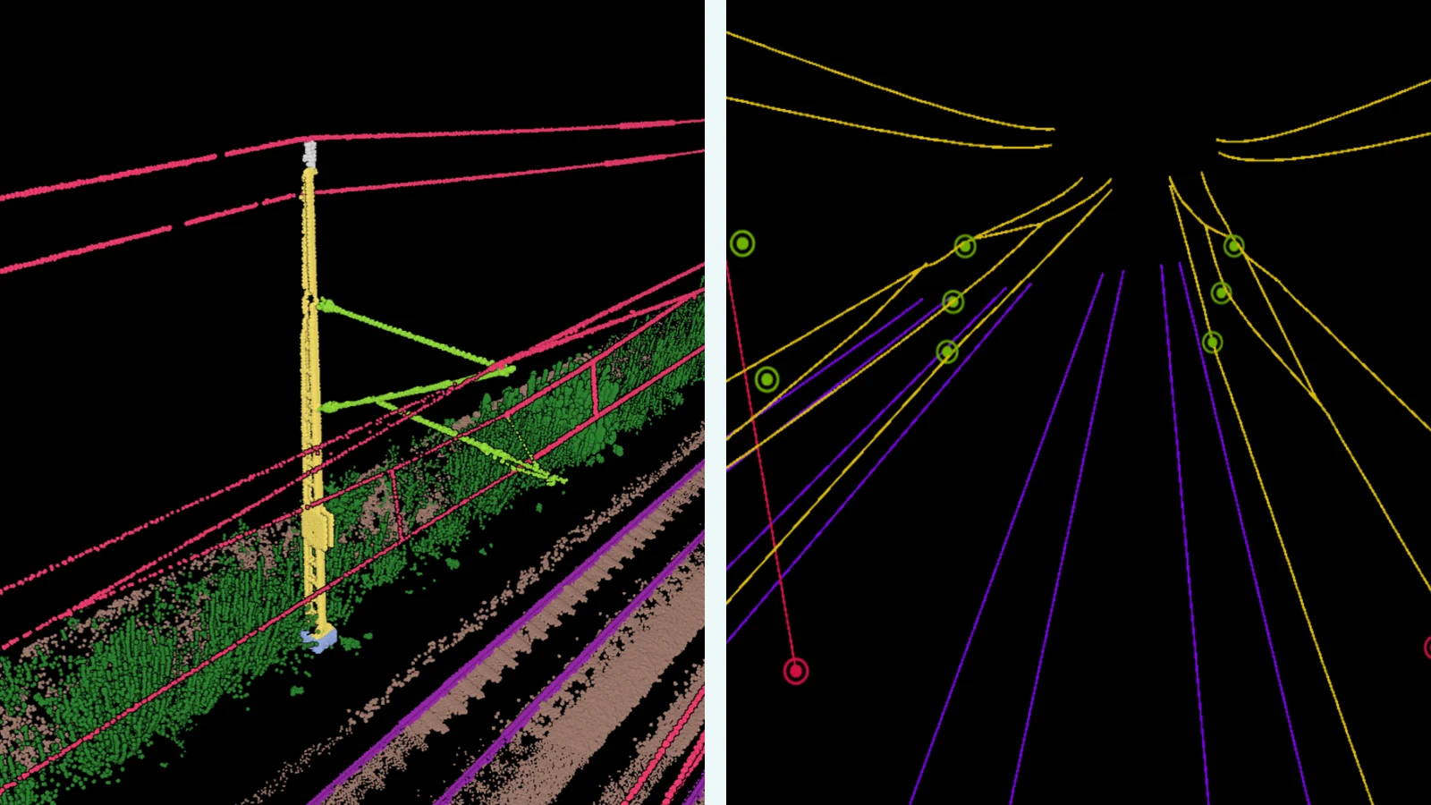
The digitalisation of railway infrastructure presents surveying and engineering companies with a central challenge: how can vast amounts of scan data be efficiently converted into actionable formats? Pointly provides the answer, with AI-based point cloud processing that automates the classification and extraction behind a BIM model.
Precise Extraction of Overhead Line Systems
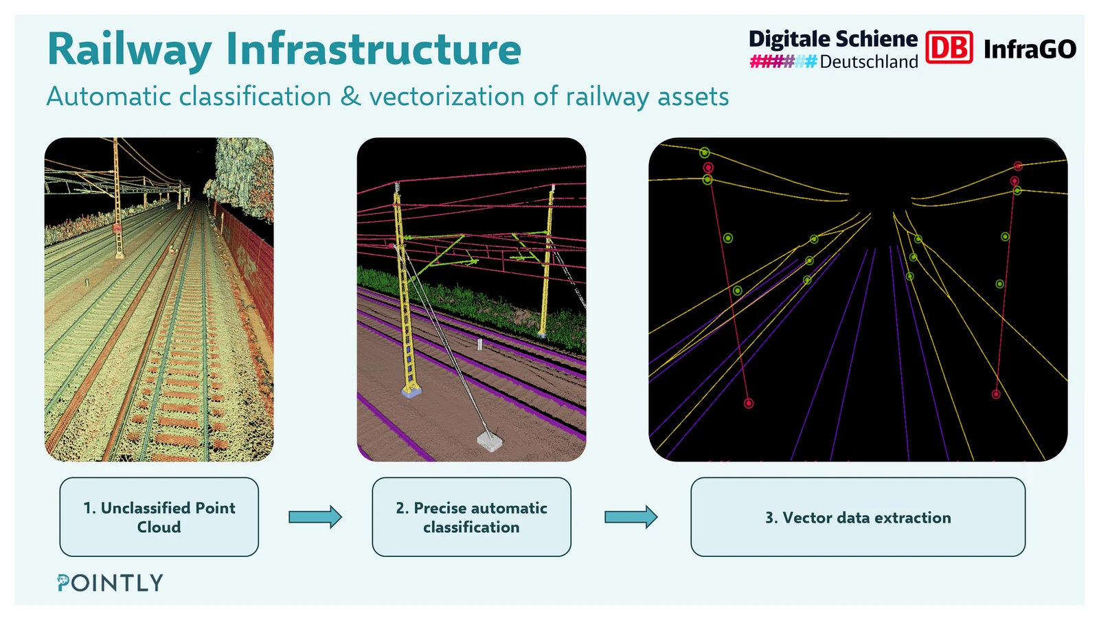
Mobile Laser Scanning (MLS) systems capture railway corridors with high precision and speed. Pointly's AI models automatically classify the resulting point clouds and convert them into structured, georeferenced 3D objects that BIM models are derived from, in a fraction of the time required by manual processing.
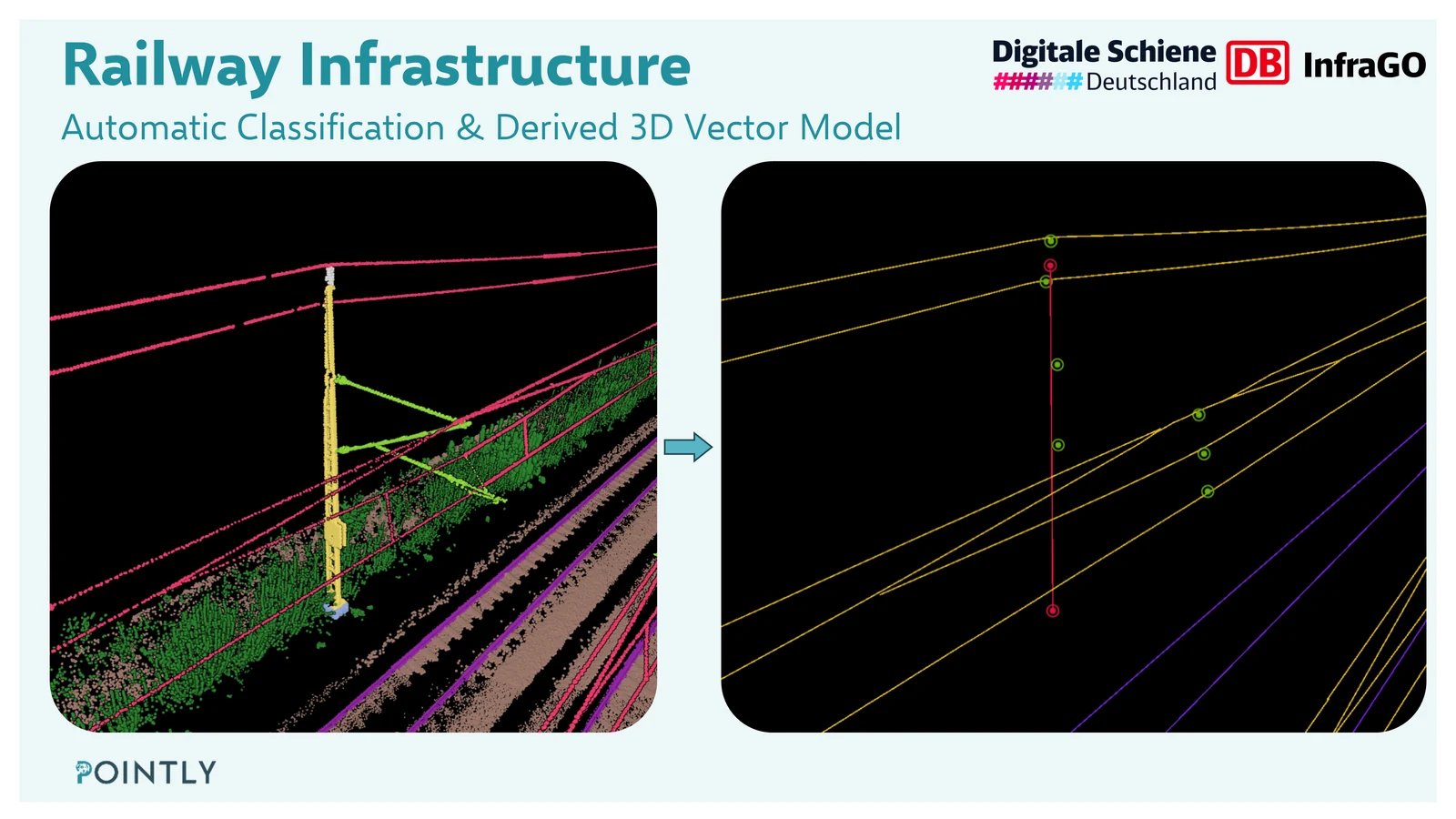
For overhead line systems, Pointly automatically extracts:
- Attachment points at mast extensions, including their exact spatial position
- Overhead wires and contact lines, fully vectorized and accurately positioned
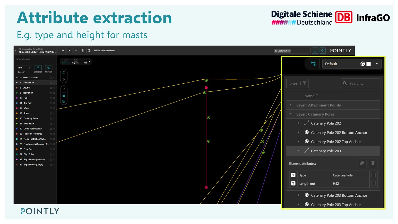
- Masts, enriched with metadata such as height, type, and orientation
Of course, the same approach applies to all other objects along the railway corridor. The workflow is fully customisable and can be adapted to specific client requirements, whether that means additional object classes, custom metadata attributes, or tailored output formats.
Structured Data for Asset Management and BIM
The extracted data feeds directly into digital twins and BIM models, machine-readable and ready for integration into existing asset management systems. Every object is not only detected but semantically enriched: with attributes, geometric relationships, and precise positioning within the corridor.
This creates a reliable foundation for maintenance planning, renewal projects, and regulatory documentation.
Read more about Rail.
Read next