Automating coastal monitoring: the Beach Classifier for Worthing Borough Council
2 min readCustom models, Projects
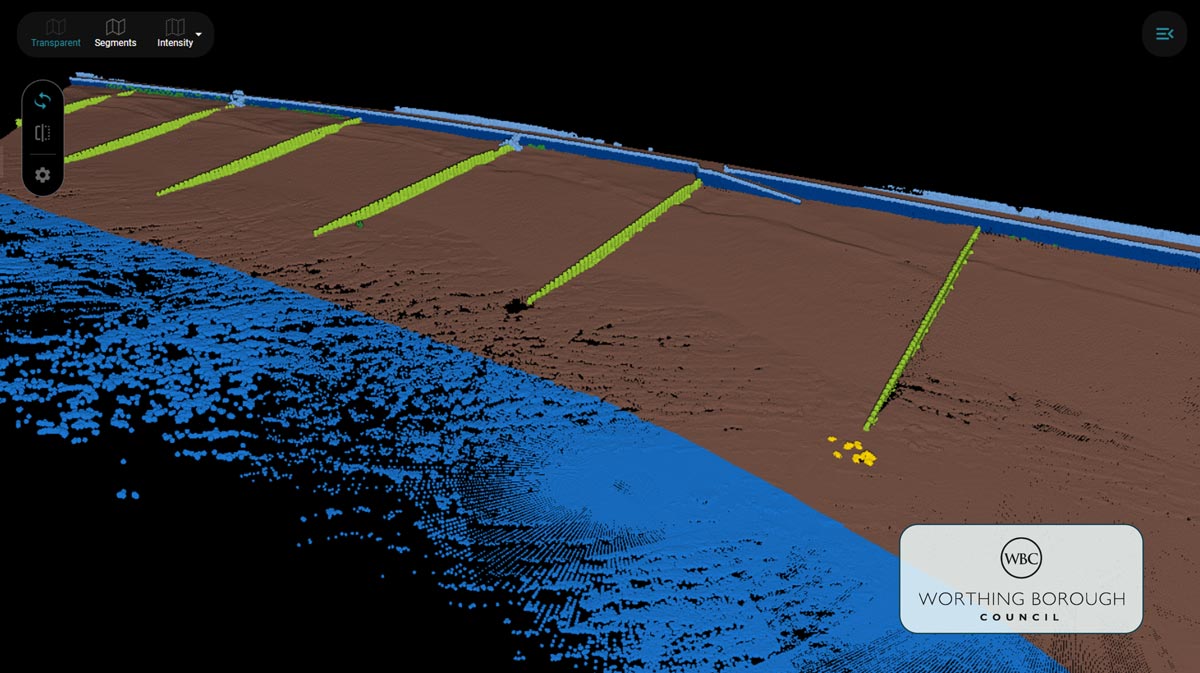
At Pointly, we are passionate about turning complex 3D data into actionable insights, whether in cities, forests, or coastal zones. That is why we are thrilled to share a recent collaboration with Worthing Borough Council on an innovative AI project: the Beach Classifier.
Mapping the coastline in 3D
Beaches are dynamic environments, constantly shaped by wind, water, and human activity. Monitoring and understanding these changes is crucial for local governments, especially in the face of climate challenges and coastal erosion. Worthing Borough Council needed a robust, scalable solution to automate the classification of coastal 3D data and Pointly delivered.
Together, we developed a custom AI classifier tailored specifically for coastal point cloud data captured along the beaches of southern England. This AI-driven approach is now helping to classify millions of data points with high accuracy and minimal manual effort.
The tech behind the Beach Classifier
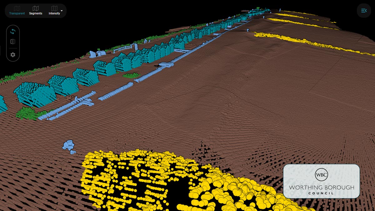
The 3D point clouds were captured using a mobile mapping laser scanner mounted on an ATV, providing dense 3D point cloud data of the beach terrain. Over a two-month project period, the Pointly team worked closely with Worthing Borough Council to fine-tune the deep learning model and several automated validation routines, to deliver a solution for the classification of the beach surfaces and infrastructure.
- Project duration. About two months.
- Training data. Over 50 semi-automatically annotated areas, around 700 million points in total.
- Training strategy. Multiple deep learning iterations, each incorporating more training data for improved performance.
- Processing. Customized pre- and post-processing routines tailored for the beach environment.
The class catalog
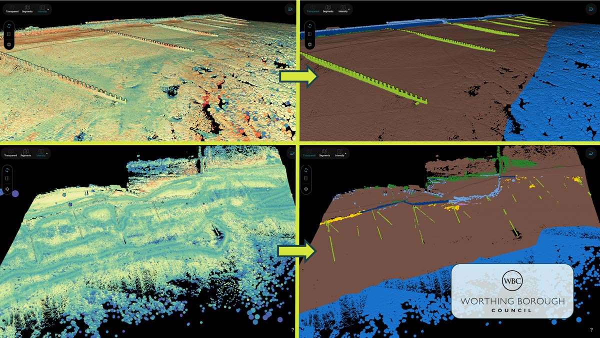
The classifier distinguishes between 10 unique classes, including ground, vegetation, seawalls, various types of groynes and structural elements, as well as other man-made objects and noise points.
This level of differentiation enables high-resolution coastal mapping and supports a wide range of use cases, from erosion monitoring to infrastructure assessment and planning.
Where it goes next
Future iterations of the Beach Classifier aim to:
- Adapt to new scanner types, ensuring compatibility with evolving hardware and improvements of the overall classification accuracy.
- Refine ground classification: by implementing a hybrid approach of AI and traditional geo-processing, the separation of terrain features from surrounding noise or low vegetation will be improved.
This project showcases the potential of Pointly in multiple applications. By automating the analysis of massive 3D datasets, Pointly empowers organizations of all kinds to make faster, more informed decisions, saving time, reducing costs, and supporting sustainable geospatial management.
A big thank you to Worthing Borough Council for their collaboration, constant feedback and input. We look forward to evolving the Beach Classifier and bringing more innovation to the coast.
Read more about Custom models.
Read next