AI meets geo data: the future of digital twins with Pointly
4 min readKnowledge
This article also appeared in the Gis.Business magazine, issue 1-2/2025, on pages 45 to 47.
The lidar boom, and the role of AI
LiDAR technologies are rapidly gaining importance and have become indispensable in fields such as surveying, construction, and urban planning. They enable the creation of 3D point clouds that serve as highly accurate digital representations of the real world.
Analyzing these point clouds involves classification processes, where each of the millions or even billions of measured points must be precisely assigned to a specific object class, such as buildings, roads, or vegetation.
Traditionally, this process is often outsourced to large workforce teams and carried out largely through manual class assignment, a highly time- and resource-intensive approach.
Pointly addresses this challenge with an innovative AI solution: the classification process is automated, increasing efficiency and enabling scalable analysis of 3D point clouds.
What Pointly is
Pointly is a SaaS solution specializing in the intelligent analysis and classification of 3D point clouds. The cloud-based platform combines advanced AI algorithms with a user-friendly interface, enabling efficient processing and management of 3D point clouds.
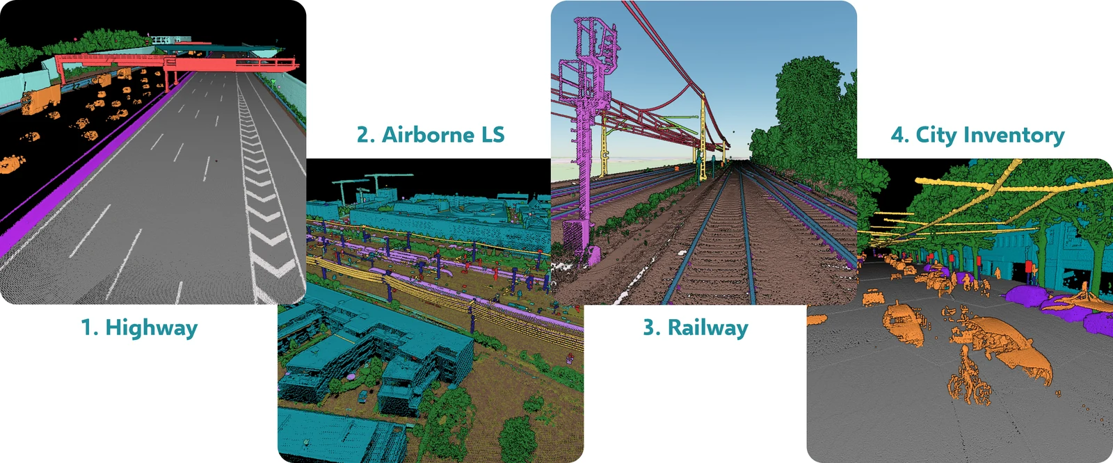
One of Pointly's key strengths lies in the flexibility of its approach: the platform trains AI models that are individually tailored to the requirements of each project. Regardless of whether the point clouds were generated via photogrammetry, airborne LiDAR, or mobile and terrestrial scanning, Pointly can classify them precisely and automatically using any class catalog.
In addition, Pointly also supports manual classification projects with intuitive tools that allow even large datasets to be processed efficiently and user-friendly. This process is used, for example, to generate training data for the AI. As a result, the platform offers a powerful solution for both fully automated and hybrid workflows.
The workflow, in five steps
Pointly combines traditional rule-based methods with state-of-the-art AI in fully automated pipelines within custom workflows to enable precise and scalable classification of 3D point clouds.
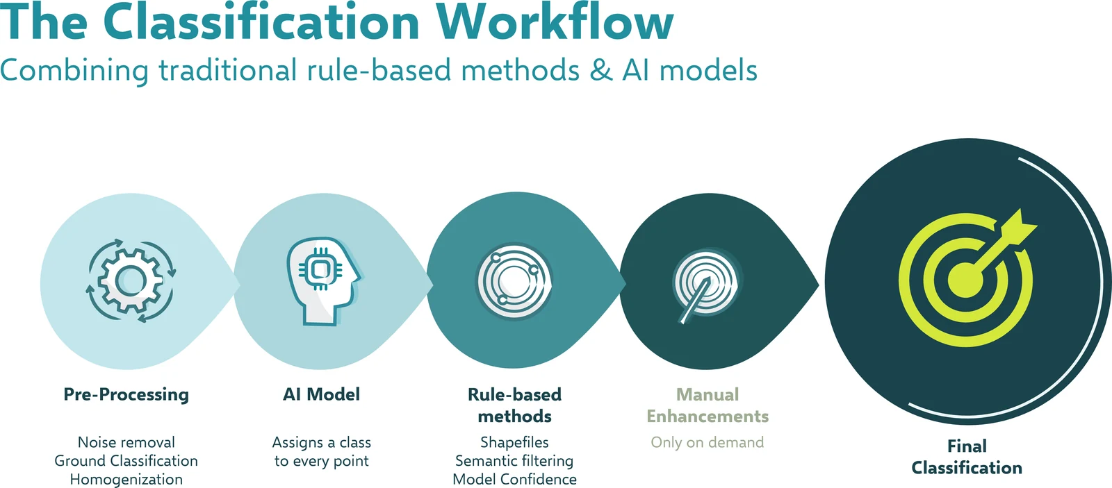
1. Pre-processing
In the first step, raw data is prepared. Disturbances in the data (e.g., noise) can already be reduced at this stage, initial ground detection can be performed, and the point clouds are homogenized to create the foundation for accurate analysis.
2. AI model
Next, an AI model classifies the point cloud by automatically assigning each point to its specific object class. The AI is the core of the classification workflow and is trained specifically for the requirements and conditions of each project to ensure optimal results.
3. Rule-based methods
In addition, rule-based approaches are used to validate or further optimize the automatic results. This includes the use of existing data such as shape files from geodatabases, semantic filtering, and the application of model metrics to ensure classification quality.
4. Manual optimization, only if needed
For particularly demanding use cases (e.g., deriving precise CAD models) and specific project requirements, users can manually refine the classification. The Pointly Platform supports this process with an intuitive point cloud viewer and efficient classification tools.
5. Final classification
The classified point cloud is the result of the process. Individual object classes can now be flexibly shown or hidden and are ready to be used for precise analyzes.
Example project: Digital Twin Germany
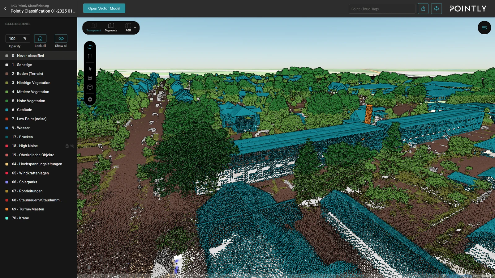
A particularly impressive example of Pointly's application is the current "Digital Twin Germany" project by the Federal Agency for Cartography and Geodesy (BKG). The goal of this initiative is to create a nationwide, high-precision 3D model that enables a wide range of applications, from climate change analysis to flood simulations.
Using LiDAR scans and a custom-trained AI model from Pointly, large portions of the point cloud data to be collected will be efficiently classified. The automated process aims to identify and digitally model objects such as buildings, vegetation, or energy infrastructure on a nationwide scale.
This approach opens up entirely new possibilities for decision-makers at the federal, state, and municipal levels: infrastructure can be planned more effectively, environmental analyzes can be carried out more quickly, and complex construction projects can be optimized.
While Pointly has already demonstrated its scalability in the classification of entire cities, this large-scale project marks a new level. As the classification partner of BSF Swissphoto, which is conducting extensive aerial surveys across Germany, Pointly is also entering a new dimension in the automated classification of 3D point clouds.
Conclusion
The combination of AI and geospatial data is revolutionizing the way point clouds are processed and utilized. With its innovative cloud platform and holistic consulting approach, Pointly enables powerful and scalable solutions to meet the challenges of modern 3D geospatial data analysis. Whether it is the efficient classification of large point clouds or the creation of digital twins, Pointly is paving the way for the future of geodata processing and setting new standards in the industry.
Author: Moritz Hartmann, Pointly GmbH
Special thanks to Gis.Business and VDE Verlag for the joint publication. The full magazine is available at vde-verlag.de.
Update. What this piece describes in general has since run at national scale: Digital Twin Germany: over 63,000 km² classified automatically.
Read more about the four ways to run Pointly.
Read next