How to export vector data from OpenStreetMap in 4 simple steps
3 min readHow-to
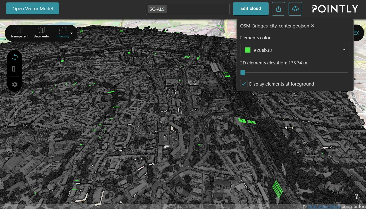
Exporting vector data from OpenStreetMap (OSM) using the Overpass Turbo web interface is a seamless way to obtain rich GeoJSON files, which can be easily imported into any GIS system. They are especially useful with the Pointly Platform to add an additional layer of contextual information in the 3D point cloud viewer.
In this guide, we'll walk you through the process and provide example queries for extracting various types of data.
Step-by-step guide to export GeoJSON from Overpass Turbo
1. Access Overpass Turbo
Visit Overpass Turbo and align the map with the extent you want to explore.
Tip: it is also possible to define a specific area in the query such as a city, state or country to extract data from.
2. Compose your query
You can write queries to extract specific data such as bridges, building footprints and water bodies. Below are some example queries.
a) Bridges
[out:json];
(
  way["bridge"="yes"]({{bbox}});
  relation["bridge"="yes"]({{bbox}});
);
out body;
>;
out skel qt;
b) Building footprints
[out:json];
(
  way["building"]({{bbox}});
  relation["building"]({{bbox}});
);
out body;
>;
out skel qt;
c) Water bodies
[out:json];
(
  way["natural"="water"]({{bbox}});
  relation["natural"="water"]({{bbox}});
);
out body;
>;
out skel qt;
d) Power Lines + Transmission Tower
[out:json];
(
  way["power"="line"]({{bbox}});
  relation["power"="line"]({{bbox}});
  node["power"="pole"]({{bbox}});
  node["power"="tower"]({{bbox}});
);
out body;
>;
out skel qt;
e) Streets
[out:json];
(
  way["highway"]({{bbox}});
);
out body;
>;
out skel qt;
f) Walkways
[out:json];
(
  way["highway"="footway"]({{bbox}});
  way["highway"="path"]({{bbox}});
  way["highway"="pedestrian"]({{bbox}});
);
out body;
>;
out skel qt;
g) Trees
[out:json];
(
  node["natural"="tree"]({{bbox}});
);
out body;
>;
out skel qt;
h) Railways
[out:json];
(
  way["railway"]({{bbox}});
);
out body;
>;
out skel qt;
i) Parking lots
[out:json];
(
  way["amenity"="parking"]({{bbox}});
  relation["amenity"="parking"]({{bbox}});
);
out body;
>;
out skel qt;
j) Street lights
[out:json];
(
  node["highway"="street_lamp"]({{bbox}});
);
out body;
>;
out skel qt;
Tip: an LLM can assist in crafting precise Overpass Turbo queries. Simply describe the type of data you need, and it can generate the appropriate query.
3. Run your query
Click the Run button to execute your query.
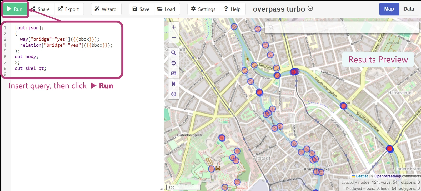
4. Export the data
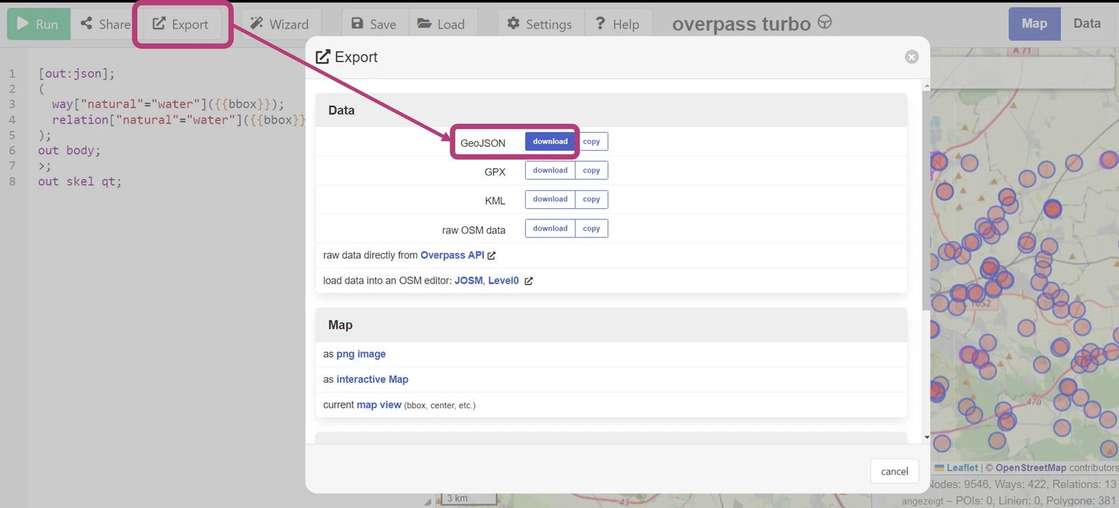
Once your query returns results, click on the Export button and select GeoJSON format to download your file.
Further feature attributes
To explore more attributes and features that can be queried from OpenStreetMap, visit the comprehensive Map Features page on the OSM Wiki. This resource provides detailed information on various tags and attributes used in OSM data, allowing for more granular and customized data extraction queries.
Importing GeoJSON to Pointly
With your GeoJSON file ready, you can now import it to Pointly, directly from the point cloud viewer. Use the import function to upload the GeoJSON file. The additional vector data will be displayed on top of your existing 3D point cloud, providing richer contextual information. You can also adapt the color as well as display height of the 2D vector objects.
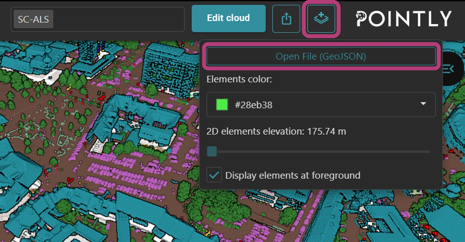
By integrating OSM vector data with Pointly, you can significantly enhance the contextual understanding and analysis of your 3D point clouds. Give it a try and see how these additional layers of information can benefit your projects!
For more tips and tutorials on leveraging Pointly's capabilities, stay tuned to our blog and feel free to reach out with any questions or suggestions.
Read more about the four ways to run Pointly.
Read next